Arthur day 2
I awoke on day 2, a restful night, well to a degree anyway I’m not one of these sleep right through kind of campers and will often wake in the early hours feeling fully rested and have to force myself back to sleep again.
What is strange is not having to wake at 5am and pack away in the cold damp morning and then set off running for 8hrs, now I can wake, take my time and actually eat breakfast.
I had set myself a goal of around 30-40 miles for each day, thinking I’m not as fit as I once was and new to cycling I had little idea of how I would get on. With the tent resting over the gate to dry the last of the morning dew and with breakfast and a hot drink inside me I planned my route for the day.
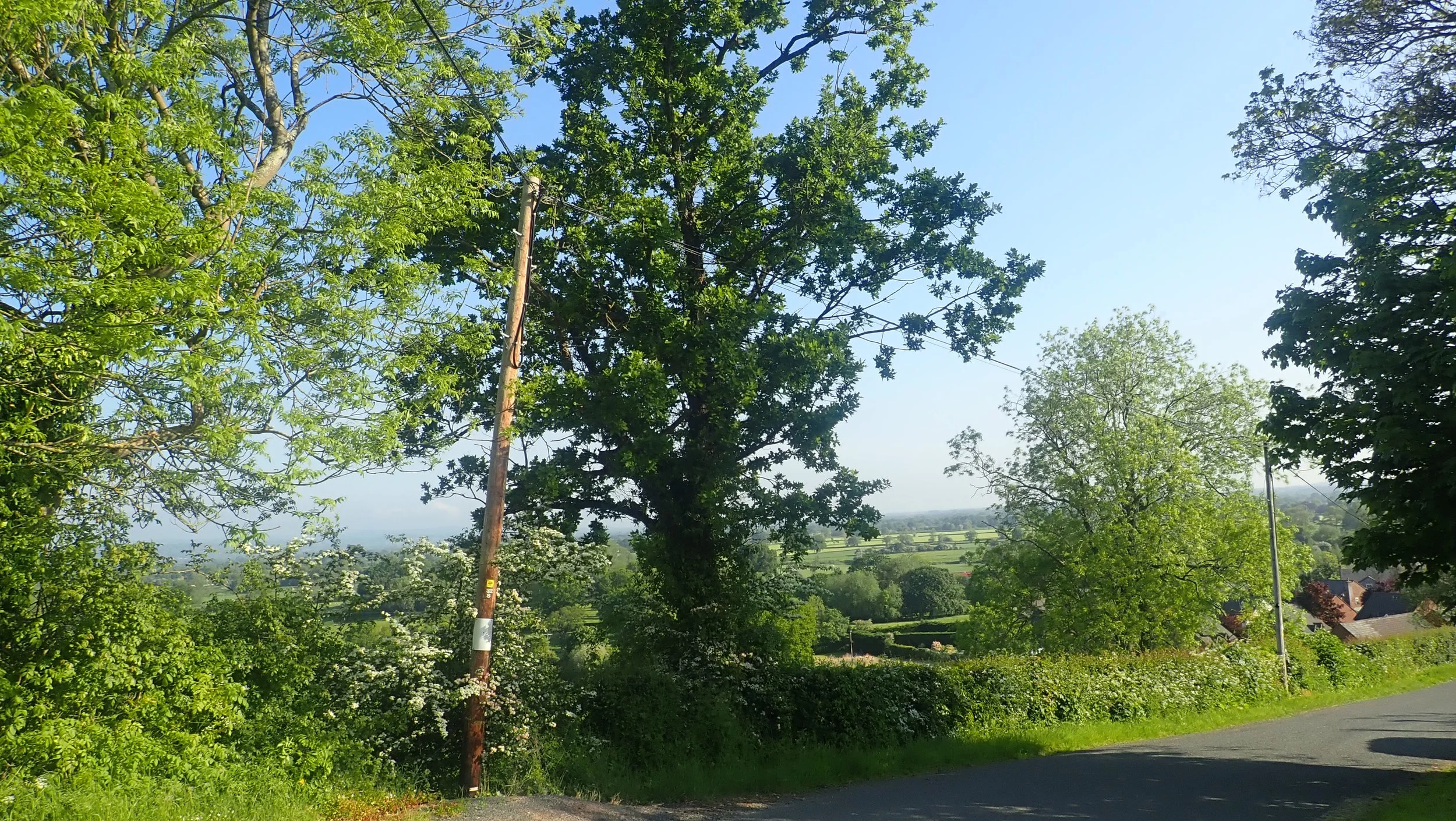
I passed by the little hamlets of Crewgreen and Wollaston before the inevitable push the bike up and onto Long Mountain, once up it became a very reasonable road which straddled the border of the Welsh and English border. Here your treated to a view which in the hot and sunny weather of today was nothing less than outstanding. Here I came across the odd bikers, some out for a morning ride, others enjoying their own bikepacking packing experience, albeit with a nice BnB slipped in for the added comfort.


The road here becomes follows the line of an old Roman road which stretched from Wroxeter to Forden Gaer, with Offas Dyke and a Iron age hill fort thrown in this simple road offers allot. As I passed a woodland it was here that I realised what the infamous arrows represented, the hill was a tad on the steep side and as I cycled down I applied my breaks which then began to overheat with some smoke thrown in for good measure and then finally my breaks stopping altogether, a quick ditch in a hedge was called for.
Disaster averted and a rather embarrassing push my bike down a hill I was able to make good time along the A490 to our first stop of the day the River Camlad. Where a bridge now crosses the Camlad a ford would of originally sat here.
Today it is simply farm land with the river gently flowing between them, a campsite sits near to this bridge also but unfortunately does not take tents, seems to be a thing these day. But back in mist of time somewhere before 500 and the earliest mention being the Annales Cambriae from 537 mentions the strife of Camlann in which Arthur and Medraut fell, Medraut later became Mordred. What makes this hypothesis even more intriguing is that there are records of an actual battle having taken place on the moor above this place between 2 great armies. Either way many people pass over this very inconspicuous area without ever realising it importance to history.


I continue on, passing through Chirbury where I stop at the Church before heading into the local shop for a much needed pie and coke, I sat in the sun and watched people go to and through, before heading over the road and off to Mitchells fold. I cycled alongside a chap running his first ultra, what a day to pick a run certainly not one id of chosen.
Here we met one unbelievably steep hill that headed up to the farm of Lower Ridge, I took a much needed seat before carrying on pushing my bike onwards and upwards, I passed only one vehicle here a pick up truck which 10 minutes later returned my way, asked where I was headed and the farmer offered a much needed lift up and onto Mitchells fold. Once having reached the top I collected my bike and walked the short distance to my next stop for the day.
Mitchell’s fold is some 3000 years old, once comprising of 30 stones but now only 15 thanks in part to years of vandalism the most recent being in 2005 when a local farmer took down some stones and was later caught and prosecuted. Like all of the stone circles there is little to say what they were for other than theories and conjecture we can only imagine what would of taken place at their height of use.


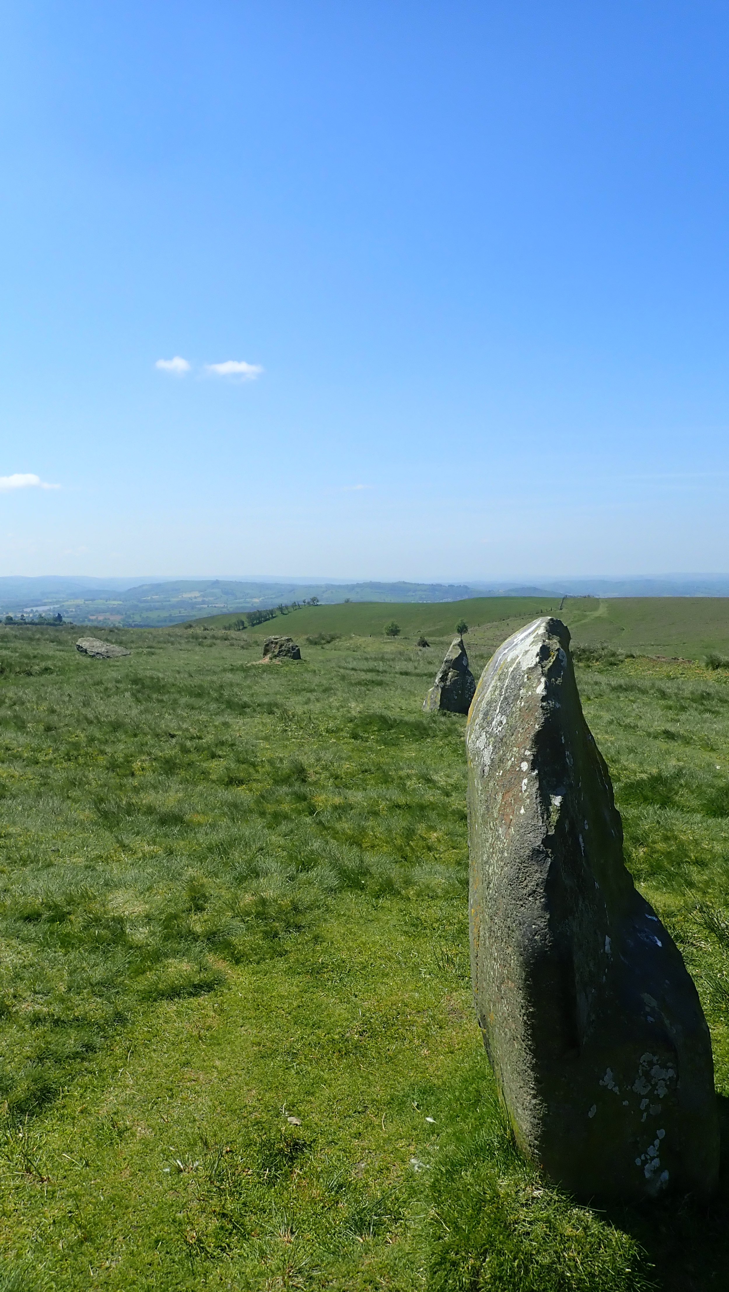


So why are we here today, well in the Arthurian legends, the great leader and king is said to have pulled a sword from a stone and then became King of all England. In all reality this is more likely down to one Geoffrey of Monmouth when he first put to paper the story of King Arthur turning him into a knight and king. You see the tale of the sword in the stone can actually be attributed to something tangible in history, when swords were first cast, a mold would be carefully produced from carving a large stone split into 2 halves and molten metal would then be poured into the hole and once cool a sword would be ‘pulled’ from the stone ready to be finished. With the many burial cairns, Tumli and forts that dot this area it is not surprising that Mitchell’s fold perhaps once held a sight of special importance to the area, it’s almost secluded spot within the many valleys of the Shropshire hills that Mitchell’s fold could of provided a place to anoint kings or choose leaders in some long forgotten ritual.
I sat, ate some snacks and soaked up the sun for a hour before heading off once again, I would of originally like to cycle across the Stapley Hills but there was little in the way of camping to be had, one thing I’ve come to realise from all my travels is that I really do not enjoy the whole looking for camp spots and hiding away. Now I prefer a camp site where I can relax in peace.
I headed down along the road towards Runnis Meadow, a large and spacious campsite bordered by a trickling river which im told is home to a family of otters. The owner is a great guy, even offering me a lift past the many and maddening hills that awaited me. I purchased some eggs from him, set up my temporary home and chilled out in the sun for what seemed like ages. There was no phone signal here and I was truly free from the confines of modern tech. Whilst my pod cast played I cooked my tea and added a few eggs for good measure I was now hungrier than I had every been and even with this in my belly I was still a little peckish. Night drew in eventually and I was able to get a good rest.


