
The Blood Queen!
Elizabeth let her robe slip from her shoulders, the fabric whispering against her skin before pooling silently at her feet. She stepped forward, the cold tiles biting at her bare soles.
Above her, suspended by rusted chains, hung a cruel iron cage. Inside, a young servant girl huddled — trembling, wide-eyed, her sobs choked back into broken silence.
With a slow, deliberate gesture, Elizabeth gave the signal. Blades flashed in the dim light, and the girl’s wrist and throat were opened.
Warm blood spilled in a sickening cascade, spattering the floor, the walls — and Elizabeth herself. She tilted her face upward, smiling as the crimson rain kissed her skin, feeling the stolen vitality seep into her like a dark blessing.
Another soul claimed. Another night fed.
Of course! Here’s your passage, restructured with correct grammar, cleaned up for flow, and made more gripping while keeping your detailed style intact:
Yes folks, today we delve into the world of the oldest known serial killer — a story drenched in the blood of over 600 victims. A tale steeped in sex, violence, and sadism, where one woman, in her relentless pursuit of youth and eternal beauty, took the lives of countless young women.
For this dark legend, we travel into the turbulent heart of the Hungarian Empire during the 16th century, a time when fierce battles against the Ottoman Empire raged for control of the land. It is here that a figure arose whose name still sends a chill down even the hardest of spines.
Our story centers on the life of Elizabeth Bathory, the infamous Countess of Hungary, whose early years were marked by trouble and trauma.
Born into the wealthy and powerful Bathory clan—a noble family whose ranks included two Princes of Transylvania, a King of Poland, and a Grand Duke of Lithuania—Elizabeth seemed destined for greatness. Yet, power often comes at a cost. The Bathorys, like many royal families of the time, practiced inbreeding to preserve their bloodline. As a result, mental illness and genetic defects plagued their descendants.
Elizabeth’s father was believed to suffer from a mental disorder, often seen being dragged in a sleigh through the searing heat of summer. King Stephen of Poland, her relative, battled kidney disease and depression, with some scholars speculating he also suffered from epilepsy. Her uncles, Christopher and Andrew Bathory, were known for their cruelty and criminal behavior.
From the tender age of six, Elizabeth herself began to suffer from epilepsy, blinding migraines, and debilitating fits. It was around this time she bore witness to unspeakable horrors, including the public execution of criminals. In one harrowing account, Elizabeth saw the brutal rape and murder of two young girls. Her father, consumed by rage, captured the perpetrator and burned him alive atop a searing iron throne.
As if this early exposure to violence wasn't enough, Elizabeth's lineage included ties to none other than Vlad the Impaler, and branches of her family bore the dragon crest — a dark omen if ever there was one. In a world where the nobility viewed the common folk as less than human, cruelty was not just accepted; it was expected.
Promised in marriage from a young age, Elizabeth wed Count Ferenc Nadasdy at just 18 years old. The union further solidified her power and influence in Hungary. Ferenc was a seasoned warrior known for his ruthless campaigns against the Ottomans, often displaying his victims impaled on swords. It is said that he tutored Elizabeth in the finer arts of torture — including a gruesome technique where paper was wedged between victims' fingers and set alight.
On their wedding day, Ferenc gifted Elizabeth an unusual present: a pair of spiked claws to use against disobedient servants. In one particularly vile story, at Elizabeth’s urging, Ferenc restrained a young servant girl, covered her in honey, and left her to be consumed by insects.
While Ferenc was away on campaign, Elizabeth occupied herself with numerous affairs and fell under the dark influence of her aunt, Klara Bathory—a known bisexual and rumored witch. Through Klara, Elizabeth was introduced to a circle of occultists, witches, and alchemists. One such figure, a gaunt, pale man dressed entirely in black—known locally as "The Vampire"—became her confidant and further fueled her sadistic appetites.
It was during this period that Elizabeth’s cruelty escalated. In 1585, she confided to her inner circle that the screams of her victims alleviated her migraines. Peasant girls, seen as expendable by the nobility, became easy targets. Any minor offense committed against the Countess could result in torture — maids were burned with hot pokers, coins were heated and pressed into their skin, and girls were dragged through the castle courtyard naked and doused with freezing water until hypothermia set in.
Other punishments were equally grotesque. Victims were beaten with birch rods, flogged with stinging nettles, or had their mouths torn open by brutal force. The cruelty grew with time, each act of violence pushing Elizabeth further into madness.
Into this sinister world entered Anna Darvulia, said to be Elizabeth’s most loyal and sadistic accomplice. However, mystery shrouds Darvulia’s identity, with some historians suggesting that her name may have been a cipher or fictional creation.
In 1604, Ferenc died under mysterious circumstances—rumors circulated that a prostitute had stabbed him or that Elizabeth and her dark cohort played a hand in his demise. With her husband gone, Elizabeth's bloodlust intensified.
Corpses piled up faster than they could be concealed. Some were dismembered and thrown into rivers and marshes, hidden among the many deaths from plague and cholera. Yet whispers grew louder, and Elizabeth, now unrestrained, began to attack victims herself. She was known to bite chunks of flesh from the living and stitch the mouths of disobedient servants shut.
The turning point came when a maid accidentally pulled Elizabeth’s hair too tightly. Enraged, Elizabeth struck the girl so hard that her blood splattered onto the Countess’s skin. Upon washing it off, Elizabeth believed her complexion looked more youthful. Whether or not she truly bathed in blood, it is recorded that she began having girls suspended in cages above her, their wrists slashed so their blood could rain down upon her, a macabre ritual for eternal youth.
Her downfall came when she set her sights beyond peasant girls, targeting young noblewomen. In 1610, the disappearances became too numerous to ignore. A secret investigation ordered by King Matthias revealed a horror beyond imagination. Testimonies from over 50 witnesses described the unspeakable acts carried out at Cachtice Castle. The investigation uncovered mutilated bodies hidden within the castle’s many tunnels.
Elizabeth’s accomplices were arrested and, under brutal torture, confessed. They were swiftly executed, while Elizabeth, protected by her noble blood, was sentenced to house arrest. She was walled up inside her castle tower with only a small opening for food to be passed through.
In 1614, Elizabeth Bathory died—her withered body found covered in bite marks on her arms and legs, with blood smeared across her mouth, as though she had turned her cannibalistic desires upon herself in her final moments.
Initially interred in the crypt at Cachtice, her body was later exhumed due to public outrage. When the tomb was opened, her remains had vanished, adding yet another chilling mystery to her legend.
While it is difficult to separate fact from folklore, Elizabeth Bathory’s life was undoubtedly shaped by the brutality, paranoia, and superstition of her time. Born into a world where loyalty could turn to betrayal in an instant, where enemies plotted from the shadows, and where bloodlines carried the curse of madness, Elizabeth was both a monster and a product of her dark age.
Perhaps she was a bloodthirsty predator. Perhaps she was a victim of political intrigue. Or perhaps... she was something far worse.

Terror on the coast, the 1700’s gang.
A gang so powerful not even the law could stop them, the infamous Hawkhurst gang of the 18th Century.
Today, much of the Southern coastline is a popular destination for tourists and families, leisurely enjoying their holidays and weekends under the warmth of the southern sun. With fish and chips in hand, children laugh and play in the sea. But this idyllic scene is a far cry from what it once was. In the 18th century, the area was plagued by a gang so feared and notorious that for nearly 20 years, they ruled the territories between Dorset and Kent, stealing goods, committing murder, and terrorising anyone who crossed them.
Local magistrates were too afraid to intervene, and the law seemed powerless in the face of this relentless band of criminals. But who were these ruthless men? What made them so powerful?

Smugglers, Rye
Britain in the 1700s: A Harsh Reality
The 1700s in Britain was a time of great suffering and inequality. Dickens’ tales of workhouses and squalid slums were only a glimpse into the grim reality faced by the lower classes. The gap between the rich and poor was vast, and those at the top—though few in number—controlled everything from the goods people bought to the land they lived on.
Illness was rampant, and many struggled to afford even a roof over their heads. For those who could scrape by, life was far from comfortable. Yet the wealthy never seemed satisfied, constantly demanding more. As the East India Company faltered, the government imposed heavy taxes on everyday goods like tea, brandy, and coffee. These taxes made smuggling incredibly profitable, attracting criminal gangs funded by wealthy investors.
Romanticising the Past: The Smuggler's Ideal
Smuggling, like many of the old crimes, has often been romanticised. We think of dashing, bold men who plundered from the government and kept their families well-fed and prosperous. But the truth is far more sinister. These were not the kind of men you’d want living near you—or even knowing you. They were violent, merciless criminals who would beat and rob the very locals who sheltered them, all out of fear. Cross them, and it could mean your life, or your family’s. These were not heroes; they were villains, pure and simple.


The Rise of the Hawkhurst Gang
One gang, however, stood head and shoulders above the rest, earning a reputation as one of the most notorious smuggling operations in the UK—the infamous Hawkhurst Gang.
The gang emerged from several smaller factions in the area, with records of their activities dating back to the early 1730s. By the mid-1700s, they had taken control of the Kentish coast, ruling with impunity. Goods flowed into the UK through the Romney Marshes, carried by pack horses and eventually making their way through the gang’s territory.

Customs house raid, Poole.
Their name came from Hawkhurst, where the gang would gather at the Oak and Ivy pub to plan their crimes. They later established a secondary headquarters at the renowned Mermaid Inn in Rye, where, by the famous ‘Giants’ foreplace, they would sit—pistols loaded and displayed on the table—plotting their next move.
The Gang’s Bloodshed Begins
By the early 1740s, the gang’s notoriety had grown, and so had their bloodlust. In one chilling incident, a young boy named James Marshall took an interest in the gang’s activities. He had been seen watching them leave a local inn, firing their guns into the air in celebration. After that night, James was never seen again.
Not long after, another man, Richard Hawkins, a local farm labourer, was accused of theft by the gang’s most brutal member, Jeremiah Curtis. Hawkins was taken by the gang, “interrogated,” and his body was later found weighted down in a lake.
The Customs Officers’ Murder: A Bold Display of Power
In 1744, the gang’s cruelty reached new heights. Two customs officers, armed with a warrant to arrest two key members of the gang, were surrounded at an inn in Sussex. The gang, refusing to let their men be taken, began firing their guns in an attempt to intimidate the neighbourhood. The officers were forced to surrender.
But the terror didn’t stop there. The gang marched the men for five miles, where one was released with a chilling warning: "Don’t tell anyone, or we’ll boil you alive." The two remaining officers were tied to trees and whipped until they begged for death. The gang then set fire to them, dousing the flames when they were near death, before eventually taking them aboard a smuggler’s ship. The officers were never seen again.
The Downfall of the Hawkhurst Gang
Despite the arrest and execution of their leaders, Arthur Grey and William Rowland, the Hawkhurst Gang’s reign of terror continued. However, their demise was inevitable. As the gang grew bolder, the locals began to fight back.
In 1747, under the leadership of Thomas Kingsmill, the gang turned their attention to the village of Goudhurst, where locals had organised a militia to defend themselves. Kingsmill, enraged by the resistance, vowed to burn the village to the ground and kill everyone in it. But what happened next was something the gang never anticipated.
The villagers, under the command of a former soldier, had been trained in arms. From a hilltop position, they ambushed the gang, forcing them into retreat. The gang, in their panic, fired at houses, killing Kingsmill’s brother and two others. This was the first time the gang had been beaten by civilians, and it marked the beginning of their downfall.

Stoning to death of customs officer in well.
The Final Days of the Hawkhurst Gang
Later that year, in another raid, the gang ambushed customs officers, capturing several and executing them in gruesome fashion. By the end of 1748, after a series of betrayals, brutal murders, and ambushes, the gang’s reign was effectively over.
The authorities, spurred on by anonymous tips, began rounding up the remaining gang members. Six were hanged as an example, and another 40 were either executed or transported to the colonies to serve out their sentences.

Murder of the Officers.
For nearly 50 years, the Hawkhurst Gang terrorised the coasts and towns of Sussex and Kent, murdering, robbing, and leaving a trail of fear in their wake. Their story serves as a dark reminder of the lawlessness that once plagued parts of Britain—and of how even the most infamous of criminal gangs can fall, undone by their own hubris and the betrayal that eventually takes them down.
Death, 160 year old coincidence?
A murder separated by 160 years, connected with more than a glancing coincidence
Here’s a revised version with a more gripping and eerie tone:
Mary walked the moonlit path through the woods, the same path she had taken countless times before. But tonight, the familiar trail felt different, darker, as if the very earth beneath her feet was holding its breath. It led to her grandfather’s house, where she would spend the night after a lively evening of dancing and laughter with her friends.
But earlier that month, she had confided in her closest friend about a chilling sense of unease, a feeling that something sinister was lurking in the shadows, waiting. She couldn’t shake the impression that an unseen presence was following her, tracking her every step. Little did she know, her instinct was far more than a mere premonition—it was a warning.
As she made her way home, the dim light of the moon barely illuminated the path ahead. Her footsteps were the only sound, her humming an unconscious attempt to ward off the growing sense of dread. The night seemed unnaturally still. Then, from the darkness ahead, she saw it—a shadow, shifting in the trees. At first, she thought it was nothing more than a trick of the light, a harmless silhouette of a tree. But the shape began to move, pulling itself free from the shadows with an eerie, deliberate pace.
Her breath caught in her throat, and a nervous laugh escaped her lips. "Oh, it’s you! You scared me," she said, her voice trembling, though she tried to sound nonchalant.
But that fleeting moment of relief would be her last.
No one would ever see Mary alive again.
This version heightens the tension and adds a darker, more foreboding atmosphere. Let me know if you’d like further adjustments!
We now take a step back in time to the year 1817. Set against the backdrop of post-Napoleonic wars, social unrest, and riots, ordinary people struggled to carry on with their lives as food shortages and unemployment soared.
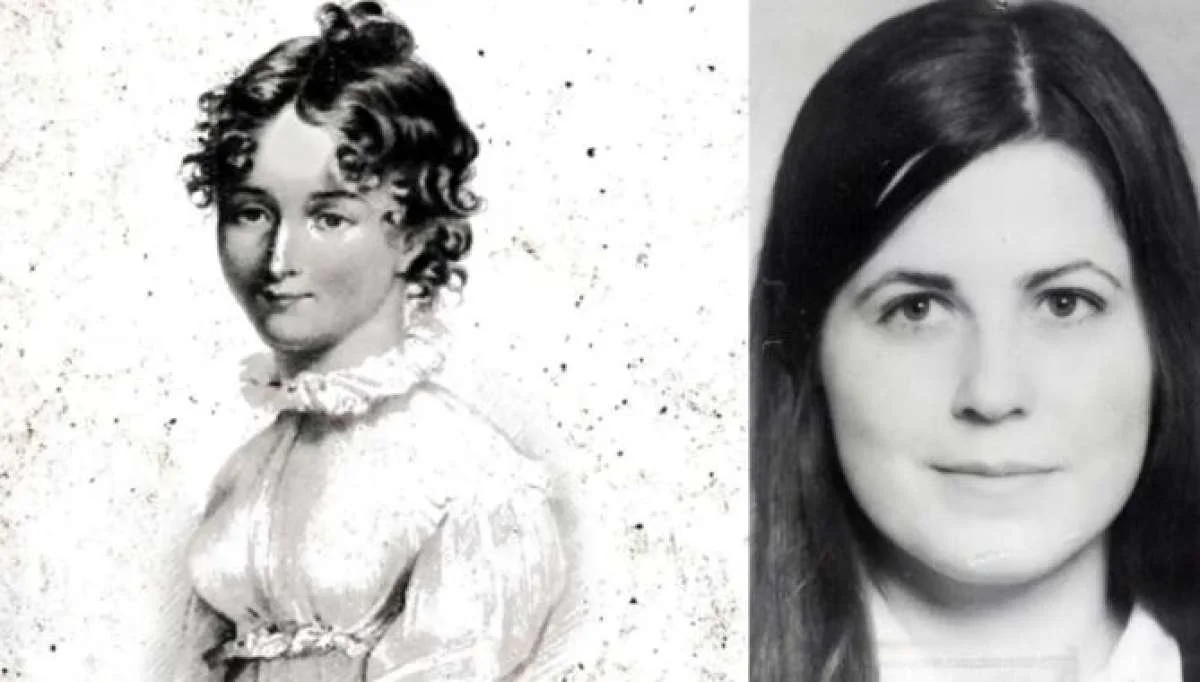
Mary Ashford, a 20-year-old native of Erdington, England, had traveled to Birmingham that day. She took her place on High Street, near Digbeth, to sell her family’s eggs and butter, hoping to provide a small but steady income for her household.

One of many images made of Mary after her murder.
Here’s the revised version with improved grammar and readability:
A walk of around seven miles, which would still be a challenge today, highlights the daily struggles faced by people in the 1800s. Birmingham was a rapidly growing industrial city, and Mary’s route from Langley Heath (Sutton Coldfield) would have taken her through a bustling area, passing many people and into the heart of the market. In those days, the markets were full of people, livestock, thieves, sellers, and buyers, all jostling for whatever money could be made. Mary, being slight of build, would no doubt have been well accustomed to this environment and capable of handling herself amidst the pushing and shoving.
After a busy day of trading, Mary began her journey towards her long-time friend, Hanna Cox, who was spending the evening with her mother, likely on Edwards Road. Mary had left a bundle of clothing at Hanna’s house earlier that morning, and the pair had changed with excitement before leaving around 7 p.m., heading for the Tyburn House. Since it was Whit Monday, a great feast and party had been planned for the area, and Mary and Hanna were eager to attend and dance the evening away.
However, that evening, a man—known as a womaniser and generally disliked by many locals—was also in attendance. In various accounts of the story, Abraham Thornton is described either as the son of a builder or the son of a wealthy local landowner, currently living with his family in Castle Bromwich.

Abraham Thornton.
Mary Ashford entered the Tyburn Inn, cutting a slender figure and a youthful beauty that she was known for throughout the area, indeed she was even said to have had several suiter’s at the time, she had soon caught the eye of Mr Thornton, so bewitched by her beauty was he that he enquired about her identity with his acquaintances and being informed Mr Thornton exclaimed
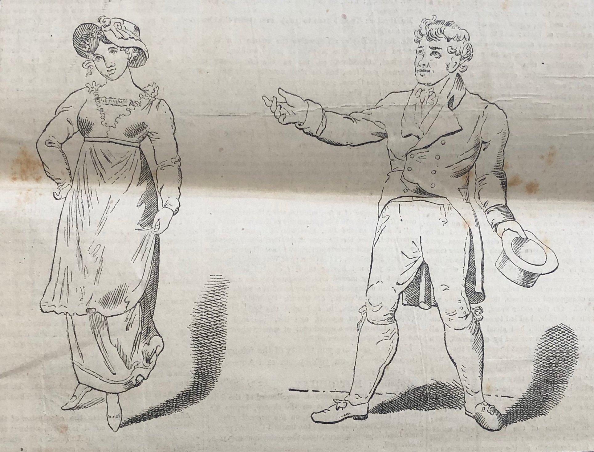
Abraham and Mary
‘I have been intimate with her sister, and I will with her’ or die by it’
This account was overheard by several people nearby, who later testified in court. The pair were soon introduced and were seen dancing together closely throughout the evening. By 11 p.m., however, Mary was ready to leave, having likely been awake since before 6 a.m. that day. Mr. Thornton, however, was insistent that she stay and spend the evening with him. Mary resisted, and with her friend Hanna, they both left, closely followed by Thornton and his friend. The four of them wandered along Chester Road in the direction of Erdington.
At Grange Lane (Road 2025), Mary and Hanna parted ways. Despite Mary’s warnings and concerns, Thornton continued to follow her, while his friend, having accompanied the ladies this far, went on his separate way.
The pair were then seen taking a stile across the fields, which are now home to a housing estate, heading toward Pype Hayes Park. They were absent for several hours. Thornton would later claim that the pair had made love in the open fields at the time, with Mary’s full consent, before parting ways.
Around 4 a.m., they were seen again near the stile by a Benjamin Cox, around Bell Lane (now Orphanage Road). After 4 a.m., Mary returned to Hanna’s home to collect her working clothes before setting off for home. Between 4 and 5 a.m., Mary was seen by several witnesses, sometimes hurriedly walking with a male and sometimes alone. Various accounts of Mary’s whereabouts during this early hour were recorded in different newspaper reports of the time.

What we do know for certain is that in the early morning of the 27th May, a labourer on his way to work had come across blood on the grass near to Pitt’s Mill on further searching he had then found items of clothing including a shoe, bonnets and various other items, he raced to fetch help and a search party was quickly organised, not long after the body of a young woman had been discovered in the flooded pit there.
Police quickly assembled and with surprisingly good detective work for the time, they were able to piece together the last few hours of the unfortunate victim, it appeared from imprints left in the ground, that She had been walking along the field when another figure, a male had been waiting in the hedgerow, what was not not known was if this person was known to her or had surprised her.
Mary had then run back the way she had come, appearing to circumvent the male until the footprints stopped. The males then continue with what was now congealed blood the sides of the footprints towards the flooded pit, here they were able to determine the had had then thrown the body of Mary into the water, one footprint on the bank having been deeper than the other.
After a post mortem was carried out, it was found that Mary had been alive at the time of her being thrown into the water, her lungs showed evidence of weed and algae from the pit showing that she had taken her last breath whilst there. Mary’s body was also covered in a number of mark around her wrist, kneck and head showing a sustained assault had taken place, the surgeon later remarked that Mary had been engaged in sex at or around the time of her death.
Now Mary was well thought of and at the court case it was she described as being of exemplary character and the manner in which she died stoked the unrest of not only the local area but the whole counttry.
Thornton a the time of her discovery was said to be at home, when an acquaintance approached him, perhaps the very same from earlier that evening had informed him of Mary’s death, he remarked that he had been with her at 4am, his friend pleaded with him to attend the police and turn himself in but instead of leaving straight away Thornton ate a hearty meal and talked with his friend about anything other than the death of Mary.
Thornton did eventually turn himself in and police were able to match the 2 separate shoe imprints to both Mary’s shoe and that of Thorntons shoe size, Thornton also had blood upon his trousers but continued to exclaim his innocence, the coroner F.B Hackett however believed that he was guilty and ordered him be remanded until the court date.

The court case took place to the watchful eye of the country, an innocent fair beauty brutally murdered and raped and then drowned by the callous and womanising Abraham Thornton, a man it seemed was not very well thought of.
For days the both sides argued their case, Thornton seemed destined for the gallows, he was in contact with Mary up until her death and witnessed by a number of people, he would not leave her alone all evening and even made the comment that he had been with her sister.
Then there was the issues of his show size being an exact match to those along side Mary’s showing that there had been a struggle at the time and finally the blood on his trousers.
Thornton how ever would claim the pair had indeed had sex and the blood was from that meeting, he also claimed that with a distance of some several miles he could not have been at the site of the murder and at home, his presence at home was confirmed by a butler/friend, with this he found not guilty and the judge ruled the evidence circumstantial.
So certain was everyone that he would be found guilty, they shock rocked the country as he was found not guilty, rumors began that his father had paid off witnesses at the time and the witness for his whereabouts being loyal to the family went along with his mater.
This was not to be the end however, later that year William Ashford, Mary’s brother successfully appealed against the decision and Thornton was again arrested, at the time a curious event occured, Thornton enacted and ancient right to trial by combat, an old Anglo-norman law that was still evidentially legal at the time, in fact it was not repealed for another 2 years in 1819.
The judge for the retrial agreed with Thornton that the evidence was not overwhelming and allowed this to go head, for whatever reason William declined, I would surmise here that given the idea of Thornton being a wealthy lad about town was all to well equipped to fight a duel with pistols of swords as fencing and shooting were active pastimes of the upper classes. Thornton was set free, but now understanding that he was perhaps the most despised person the country booked a one way ticket to America where he disembarked at New York and vanished into obscurity.

medieval trial by combat
Mary’s headstone can still be seen at the Holy Trinity Church, Sutton Coldfield.
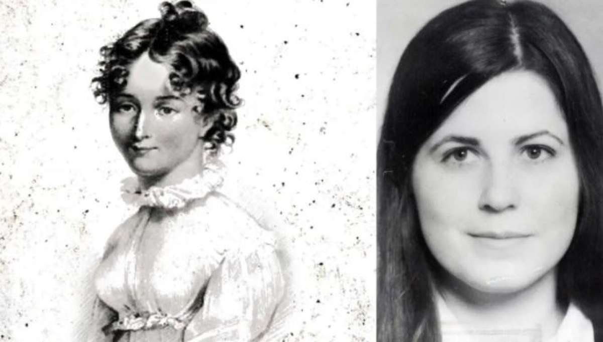
160 years later, another murder was to take place that eerily matched the circumstances of Mary Ashford.
On May 27th 1974, Barbara Forrest a 20 yo care work then working at the Pype Hayes children’s home was out enjoying the day with her boyfriend whilst he filmed at a church services, some newspaper reports stated that Barbara was out a discotheque in Handsworth area and with her boyfriend they went to Colmore Road, Birmingham where she would catch the no 67 bus to the staff quatre’s at the Pype Hayes home, Barbara never arrived and she was missing for approximately a week.

In what was to become an unsettling coincidence, the body of Barbara Forrest was discovered at around 7pm on the June 4th, she had been strangled and sexually assaulted before her murder and attempt at hiding her body.
Police carried out a widespread search for information, staging a number of recreations with a police woman wearing clothing that Barbara would have worn that evening, they carried out extensive door to door enquiries and even patrolled the number 67 bus route asking those on board for any help or information.
Police even sent divers into the lakes at Pype Hayes in the hope of clues but for 3 months very little was found, then her co worker Michael Thornton was arrested and charged with her murder, quite how and why Michael was arrested is not recorded anywhere or what evidence the police went by in order to bring about this charge remains a mystery in itself.
Michael was detained and blood was discovered on some items of his clothing, but being 1984 DNA testing and linking for crime was not yet available, despite this Michael had provided an alibi for the evening of the murder but that alibi provided by his mother was found to be false, Michael had stated that he had been in London that day with a friend drinking and they had travelled home together, however it seems that he would of been in Birmingham at the time of the murder.

Michael Ian Thornton, suspect.
Some days later, a 15yo girl came forward and claimed that she had been the victim of an attempted attack not far from Colmore Road, she had been approached by a male in a blue car who had asked her to get in under the offer of a lift, when she declined the man left, but feeling uncomfortable waiting there, she left and was followed by an unknown male who attempted to attack her, she was able to free herself and leave the area and this man was never traced nor did it seem the information taken into account or linked to Barbara’s death, no one was ever linked or traced in respects of the death.
At the time of the court case, the Judge ruled that the evidence provided was purely circumstantial and found not guilty, Michael Like Abraham had disappeared into obscurity and would not be close to 90 years old.
Summary.
Here is the odd thing about these two seemingly separate cases.
Both Mary and Barbara were 20yo at the time of their deaths, both had been out at a dance and both had been seen by close friends that evening.
Both accused had the surname Thornton and both were found not guilty as the evidence was circumstantial.
Mary died on Whit Monday and Barbara the day after and some claim they ever shared the same birthday.
They both met their end in a similar way and only yards apart.
Both had reported to friends of feeling uneasy or anxious about the coming weeks, feeling as if something bad was going to happen to them.
160 years separate these two unfortunate women, both had their lives taken before they had really begun and the killer was never found, were they a coincidence, or where they fated to play over the same events 160 years later.
As late as 2013, Barbara Forrest’s sister was continuing to fight for justice, carrying out an interview with the Birmingham Mail, she called upon the West Midlands police force to carry out further DNA testing and to re-open the case, in response, the police stated that each cold case was subject to periodical reviews and each would be looked at, in the case of Barbar, no further testing or investigation was currently warranted and no further DNA testing was available.
This case still remains a series of strange coincidences, 2 women, the same age and bearing a striking resemblance to each other, both met their fate in near identical ways, by 2 men who shared the same surname and both had ‘circumstantial’ evidence pitted against them. Do we believe these are just uncanny resemblances of history repeating itself.

The Head of Terror.
In 1971, an innocuous discovery in a seemingly ordinary Northumberland garden would trigger a series of chilling events that have baffled and terrified those involved for over three decades. The story of the Hexham Heads has become a legend, but what’s the truth behind these eerie stone objects?
In today’s blog, we delve deep into the mystery of the Hexham Heads.
The Mystery Unfolds in Hexham, 1971
It all began when two brothers, Colin and Leslie Robson, were innocently playing in their back garden. Some versions of the story say they were throwing stones at each other, while others suggest they were digging in the soil. Either way, they uncovered something far more unsettling than they could ever have imagined—a discovery that would haunt their family for the rest of their lives.
As they dug, they unearthed two small stone objects, each about the size of a tennis ball. When they cleaned off the dirt and debris, they were stunned to find that the stones were oddly uniform, almost like sculptures—and each had humanoid features.
Excited and intrigued, the brothers hurried inside to show their mother. She, too, was curious, but little did she know that this innocent find would set off a chain of strange, terrifying events. The Robsons would soon realise that these heads were far from ordinary.

No 3 Rede Avenue
A palpable shift in the air seemed to take place in the house, as though something ancient and malevolent had been awakened. The strange heads would move by themselves, particularly at night. The furniture would shift, lights would flicker—even though the power was perfectly functional—and doors would swing open without explanation. The family, already unsettled, grew increasingly terrified as bizarre phenomena continued to unfold.

Des Craigie with the heads he made.
One day, Mrs. Robson decided to show the heads to a neighbour, hoping a fresh pair of eyes would shed light on their strange find. But whatever curse had attached itself to the heads didn’t stay confined to the Robson home. The very next door neighbours, the Dodds, began experiencing their own terrifying episodes.
The paranormal activity in the Robson household intensified—children’s hair was yanked while they slept, shards of glass mysteriously appeared in their sister’s bed. Meanwhile, the Dodds were faced with an even darker presence. Mrs. Dodd reported seeing a half-man, half-goat creature standing in her bedroom. When she screamed, it turned and calmly walked down the stairs.

The Robson boys claimed to have found the heads.
Terrified, the Dodds applied for an urgent move, which was granted. They left their home—and the Robsons—behind, never to return. The Robsons, realising that these heads were somehow responsible for the terrifying events, tried to rid themselves of the cursed objects. Instead of discarding them, they handed them over to the authorities, where they were held for examination at Newcastle University. The heads also made brief stops at Hexham Abbey and Southampton University.
The heads travelled far and wide, subject to scrutiny from various experts, all of whom disagreed on their origins, size, and composition. Some claimed they were made from sandstone, others said they were made from an unknown cement-like substance. Despite these investigations, the mystery remained unsolved. What was certain, however, was that the heads were somehow tied to something dark.

The heads were described as male and female—yet the descriptions only deepened the mystery. The male head was said to have hair covering its eyes, while the female was described as grotesque, with bulging eyes, a beaked nose, and, in some accounts, dubbed “the witch.”
The Theory of Dr. Anne Ross
For years, the heads remained an enigma. But then, in an unexpected twist, Dr. Anne Ross, a respected archaeologist and Celtic expert, was sent photos of the objects by her colleagues. She was quick to proclaim them of Celtic origin.
Eager to investigate further, Dr. Ross requested the heads be sent to her for more in-depth study. And so, the objects embarked on yet another journey—this time into the hands of a determined scholar. But as soon as Dr. Ross began her research, strange things started to happen again. It seemed the curse had transferred to her.
When Dr. Ross received the heads, she immediately noted the coldness that radiated from them and an overwhelming sense of unease. Hoping to continue her research in the comfort of her own home, she placed the heads in her office. But the terror was only just beginning.

True iron age stone head, Corleck 3 sided head.
Two nights later, Dr. Ross was awoken by a deep sense of dread. The air in her bedroom had turned bitterly cold. As she strained her eyes in the darkness, she saw a figure standing in her doorway—tall, over six feet, and eerily resembling a half-man, half-wolf creature. She described it as being a menacing, beast-like presence. Inexplicably, Dr. Ross rose from her bed to follow the figure, which seemed to disappear before her eyes.
The creature appeared to jump from the landing and into the hallway, its back heavy with black fur— unmistakably wolf-like. Terrified, Dr. Ross fled back to her room and woke her husband. Together, they searched the house, but found nothing.
The mystery deepened when Dr. Ross’s daughter, Bernice, returned home from school a few days later. Normally greeted by their pet cat, Bernice found the animal cowering in the living room. When she approached it, the cat hissed and scratched at her. As she looked up, she saw a shadowy figure emerging from the landing. It was the same wolf-like creature that had haunted her mother. Fearing for her safety, Bernice hid in a room, clutching the cat.
When Dr. Ross and her husband returned home, they found their daughter in a state of terror. Bernice was shaking and pale, still in shock from what she had witnessed. Concerned for their family’s safety, Dr. Ross’s husband demanded the heads be removed from the house immediately.
A Mysterious Visitor: Des Craigie
Then, just when it seemed like the mystery couldn’t get any stranger, a local man named Des Craigie contacted the press, claiming to know the origin of the heads. Des was, in fact, the previous resident of the house at No. 3 Reded Avenue, where the heads had been discovered. According to Des, the heads were not ancient artifacts at all, but were instead made by him as playthings for his daughters. Des even produced replicas that closely resembled the original heads.
But Dr. Ross dismissed Des’s claims, calling them a work of fiction. As the heads changed hands again, further examination only seemed to undermine her theories. The mystery deepened as each new analysis failed to provide conclusive answers. One chemist, Don Robinson, even speculated that the heads could be imbued with memories or spirits from their time of use. He published a book called Secret Language of Stones, suggesting that places like Stonehenge and the Ring of Brodgar held magnetic fields capable of affecting objects like the Hexham Heads.
The heads eventually passed into the hands of Frank Hyde, an astrologer and dowser, who performed his own experiments but vanished without a trace. It’s unclear whether he had simply disappeared or if the heads had somehow claimed yet another victim.
The Big Question: Hoax or Real?
Could the Hexham Heads be genuine artifacts, or were they simply an elaborate hoax? The circumstances of their discovery raise doubts. If the boys had been digging in such shallow soil, it’s unlikely they would have unearthed objects of such apparent significance, especially considering that the area had been heavily landscaped in the 1950s and 1960s.
Dr. Ross’s theory that the heads were linked to a Celtic shrine remains speculative. Archaeological surveys conducted in the area found no evidence of significant settlements before the 7th century, making it highly unlikely that the heads could have originated from such an ancient site.
Some have speculated that the heads were the product of modern craftsmanship. Des Craigie’s replicas, which were strikingly similar to the original heads, further fuelled this suspicion. And with Frank Hyde’s mysterious disappearance, the story takes on even more of a surreal, almost mythical quality.
So, what’s the truth behind the Hexham Heads? Are they an ancient Celtic mystery, or the result of a hoax perpetuated over decades? The answers may never fully emerge, but one thing is certain: the tale of the Hexham Heads has left an indelible mark on the paranormal world—and on the lives of those involved.
What do you think—hoax or real?
Sleep well, and be cautious if you ever find strange objects buried in your garden.

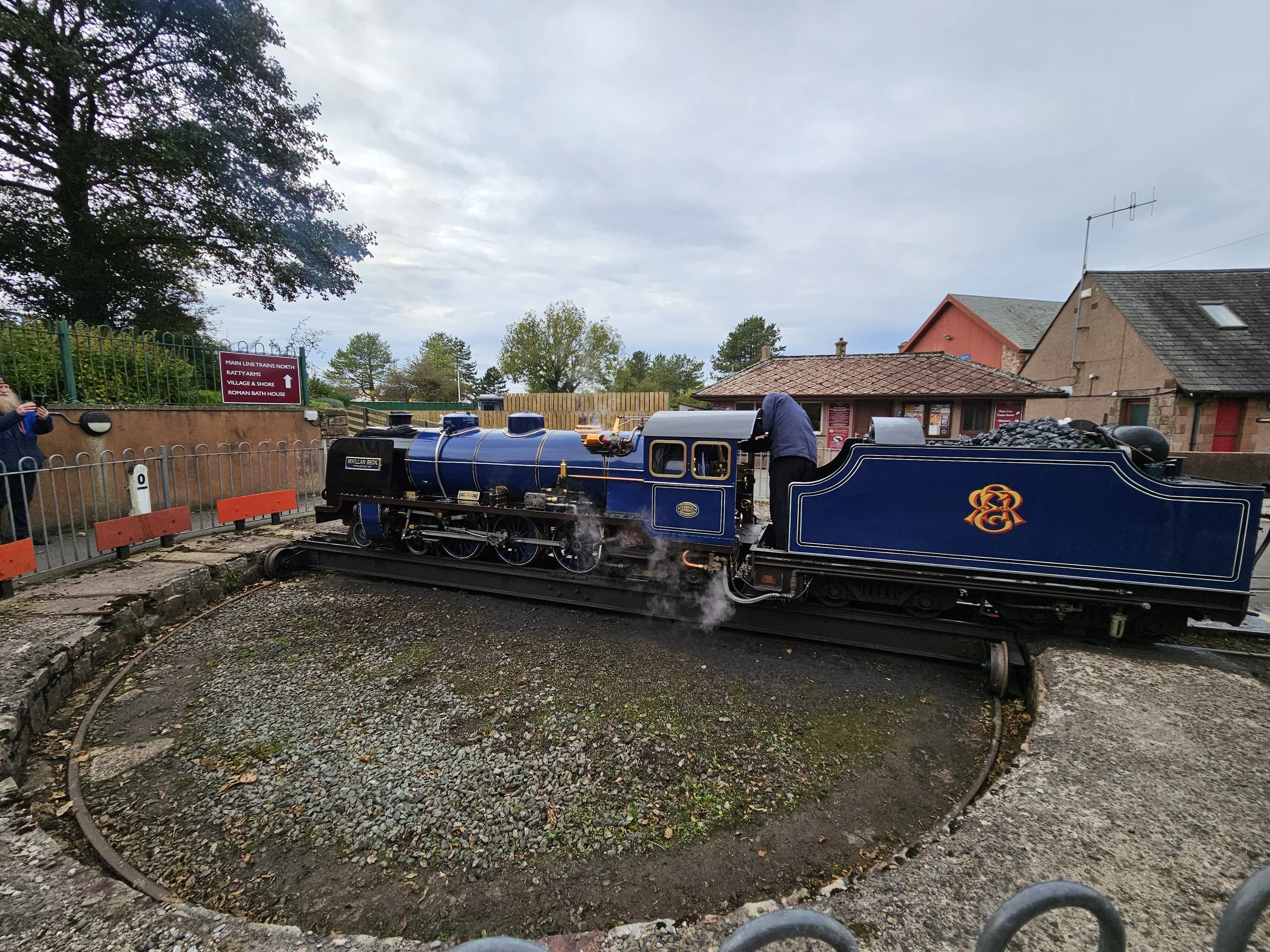
A lake district escapade.
Christmas 2023 my lovely wife had given me a fantastic present, one which would take me along a memory lane.
We were heading into the quietest part of the fabulous Lake District and onto a fantastic miniature railway that I had not been on since I was a little one.
The Ravensglass to Eskdale railway has been in some form of use since around 1873, originally built as a means of transporting valuable Iron Ore from the village of Boot to the Furness coast and onto onward to Barrow in Furness via rail line.
We had decided to make a bit of an outing with an overnight stop in the beautiful Eskdale valley the night before, with bags packed and an air of adventure off we set only 20 minutes later to be stopped on the M6 not more than 20 minutes outside of Birmingham by a car fire, a tad selfish of the person but still (joking).
Time passed easily as we zoomed up the motorway with somewhat of a surprising ease and before long we were entering Morecambe, now its worth noting I had not been here for around 20 years, maybe more and as we entered the outskirts I laughed as I realised very little had changed, in fact nothing had changed and the only thing time had done was close down a few more building and made the rest appear as if it had been through a recent war.
We parked up in what was the main town car park, once as I remember being quite a buzzing center of the town, I regaled Kerry with my memories as we wandered through the erm, interesting indoor market, where traders plied their goods and people could not do with enough phones cases.
We took a walk along the sea front passing the art deco hotel which seemed to be looking its age these days, I remember a few years ago when it first opened and it was slightly and still is at odds with a town slowly fading away like many Victorian hay day towns.


We spent a little time in a delightful cafe on the pier, before taking a little time looking out to see, I was able to see Piel Island and the coast road so familiar with many a childhood memory before wandering off again, we walked past the Old railway station now a pub and I told Kerry about the many times we had come into Morecambe via here, the old trains allowing us to stick our heads of out the windows, moving trains in the old days eh.
Strolling along the seafront, the town was certainly showing its age with many places closed or closing and yet still there were many places that I had been into as a kid that had not changed a singled bit, withstanding the movement of times and fads to remains forever in that 80s esq style.
Kerry being Kerry wished to head into the local charity shops which were a treat for the eye before we partook in the tourist tradition of grabbing some novelty rock, we were then treated to a rather nice showing of local flesh. A man in an electric buggy who had just been buying a hefty bag of sugar products to help his already ample frame keep its less than athletic shape, we one looked closer they were treated to a rather full frontal view of the persons nether regions, having not bothered to pull up his tracksuit bottoms for the last year leaving everyone to see what he did not have to offer.
Still this was momentarily put aside for what is the most well known attraction to Morecambe, the statue of Eric Morecambe in honor of the towns most famous resident, with snaps taken off we trotted again heading into the vast emptiness of the Western Lakes.
We threaded along the all to familiar A590, the only road leading away from my home town of Barrow-in-Furness, when asked we would always say the longest road to a cul-de-sac in Europe, one does not simply pass through Barrow on the way to somewhere more exciting, but forced to endlessly drive into a less than stellar finish.
We turned off eventually at Greenodd, the road was once the main route towards the Western side of the Lakes District, so narrow was it that once a large truck carrying a propellor for a new submarine built at Barrow, struck the corner of a building partially demolishing it.
We traversed the less travelled back roads of the Lakes, ones the tourist seems at odds with travelling them, unable to break away from the trap spots of Windermere and Coniston, incidentally I never enjoyed these places as a child, they were always oddly full of tourist from the far east, snapping pictures of what to most is mundane, pavements and cobbles, lamp post and most likely dog crap.
Only in England can places be named so interestingly named, little villages called Beanthwaite, Wreaks end and Bigert Mire spread out in a vastness the traveler would be surprised in such a hot spot of tourism. From these remote spots you were offered an amazing view across endless mountains un-spoilt by the hands of man.


We were soon coming upon our BnB for the evening, unfortunately Kerry being a southerner, (a southerner is to me anyone south of my home town Barrow, this would also include the town not more than 10 minutes down the road) was unable to understand my pronunciation of place names and after a short while and some interpretation I was able to spell out Bower House Inn to her.
We pulled in, checking in and grabbed our keys to settle into our lovely little pub with a view of the Muncaster fells, the last time I saw this was during Projectparkrun2019 and at the time I was nearly drowned in the torrential rain that swamped me as I crossed the tops.
Tea that night was a lovely Steak pie and mash and then off to bed for a good nights rests and tomorrows adventure.
After a stout breakfast and little wander across the fields behind the pub, we headed into Ravensglass for a short stroll before out train journey began, Ravensglass is an odd little place, a port town dating from at least the Roman period if not before, an important place where exotic goods would be delivered and then transported onwards to the rest of Cumbria and beyond, now it stands still, quiet in its sea side clothes. I had finished here on my epic Yorkshire and Lake District crossing, a gorgeous BnB my home for the night before an extraordinarily long train ride home, the Bnb no longer a place of rest for the weary traveler, a likely victim of the COVID epidemic that saw much of the industry hit and suffer.
As we walked the little road that was the hamlet, we could hear large explosions emanating from the MOD target range nearby, they certainly gave one a startle, I stood on the sands and soaked up the sun, wind and smell in a moment of bitter sweet memory, remembering how fit I was once was, what I had achieved and everything that had happened since.


We were soon at the station and after a quick tour of the museum in which I learned about a few new characters that society at large seems to not be aware of, we were shown to our private carriage, lush red velvet seating only seen the most splendid Victorian palatial homes, we tucked excitedly into our goody bag, Kerry happy that Prosecco, crisps and wine were all packed into a rather lovely tote bag, (I think it is a woman’s thing, tote bags).
The train wound it’s way through little valleys and villages, mountains enclosed us at each turn offering a view that could easily rival those in the alps and to think this was once the daily life of the miners working hard at quarries all day.
With a brief stop off and Dalegarth and a rather delicious lunch, we retraced our steps back to Ravensglass and what a treat, something to make this old body of mine feel that little bit younger. I had never considered myself a train guy before, definitely not one of the types with warm lemon tea and Jam sarnies taking notes of each and every number that comes past, but what is there not to enjoy about a tiny little train.


We headed off up towards Hard Knott pass and the Roman fort there, I knew Hard Knott pass as being routinely voted as one of the most difficult roads in the UK to traverse, now when I posted the video on Youtube, a kindly sole remarked that It did not look difficult, that I had 0 confidence in my driving abilities and that they would happily take their 7.5 tone camper over there in the summer. I chuckled at this remark, the person had clearly never been anywhere like this and seemed to have joined that day just to make that comment to me.
We started our ascent, step and winding for around 10 minutes, with first and second gears being fully used to their maximum rev range, before a pull in and explore of the Roman fort.
When I am stood within ancient places of habitation, I always try to put myself in the mind of the person occupying the area, what must if of felt like stationed up here seemingly beyond the boundaries of human civilization. It seemed even today with our car but 5minutes away that we were a world away from people and problems, wind howling along and up the pass whilst barely anything but sheep moved around the surrounding hillside.
Winter here must of been somethings these poor fellows had never imagined, coming from a warm Mediterranean climate to one so harsh that it could only be retold through tales and folklore.
After a wander, we headed off again and this time it became that little bit more challenging, with the mid section of this road being the most tricky, now it is worth noting that Hard Knott pass is only the second road in the UK to hold the 33% gradient hill, the other being a road in the Yorkshire Dales, but it is not the 33% that makes it difficult more the camber and corners where all but two wheels maintain contact and if not for the lightness of the vehicle i’m sure we would struggle to gain momentum here.
Kerry offered up some comedy value, as we drove along, my concentration at an all time high, where I was accompanied along the way by screams and shouts of terror, ‘I’m going to die’ being shouted at one point, even funnier was breeching the top where neither of us were unable to see over to the other side so had no idea if anything was coming the other way, holding our breaths we finally made the descent and with plenty of slow speed and breaking we were at the bottom and met with the most amazing view across the valley with barely a whisper of human habitation to be seen.


We decided that a brief stop off at a place we were always threatened with as kids, Tebay services, a place that could best be described as having survived an apocalypse and now lived on the misery that travelers brought hoping to find some semblance of peace, or that was how I remember it looking when I was a child.
Along the M6 and treated once more to the majestic hills before we drove into the service station, now it was model of upmarket service stations, much like that of Gloustershire services, where a farm shop served local amazing produce and employed only local people, local to here was a 50 mile radius though.
We ate, drank tea before our little 24hrs was over.

Cornwall, it’s not Arthur’s I’m afraid.
A brief look into the world of King Arthur, man, myth or tourist attraction.
I love all the mythology of the UK, with thousands of years of history we are very lucky to have such a rich and varied story telling history, but sometimes there a few things within the mythology field that just, well it irritates me. One such thing is the whole Arthurian subject, remember the knights in armor galloping away on war horses saving damsels and fighting mythical beast across the land, yes that fella.
I’m no historian or archeologist, but I am someone who knows a great deal about mythology and love the stories of history.
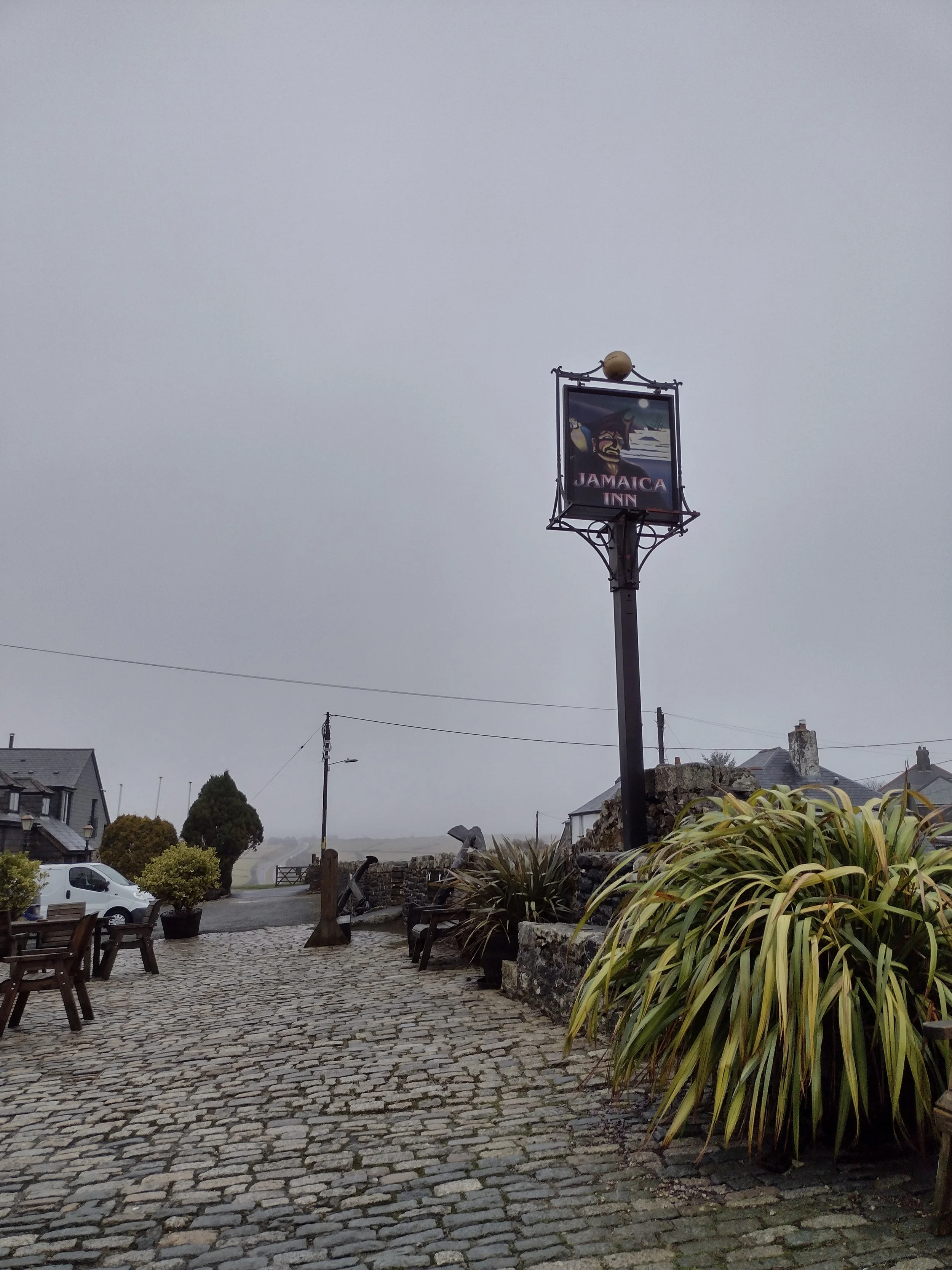
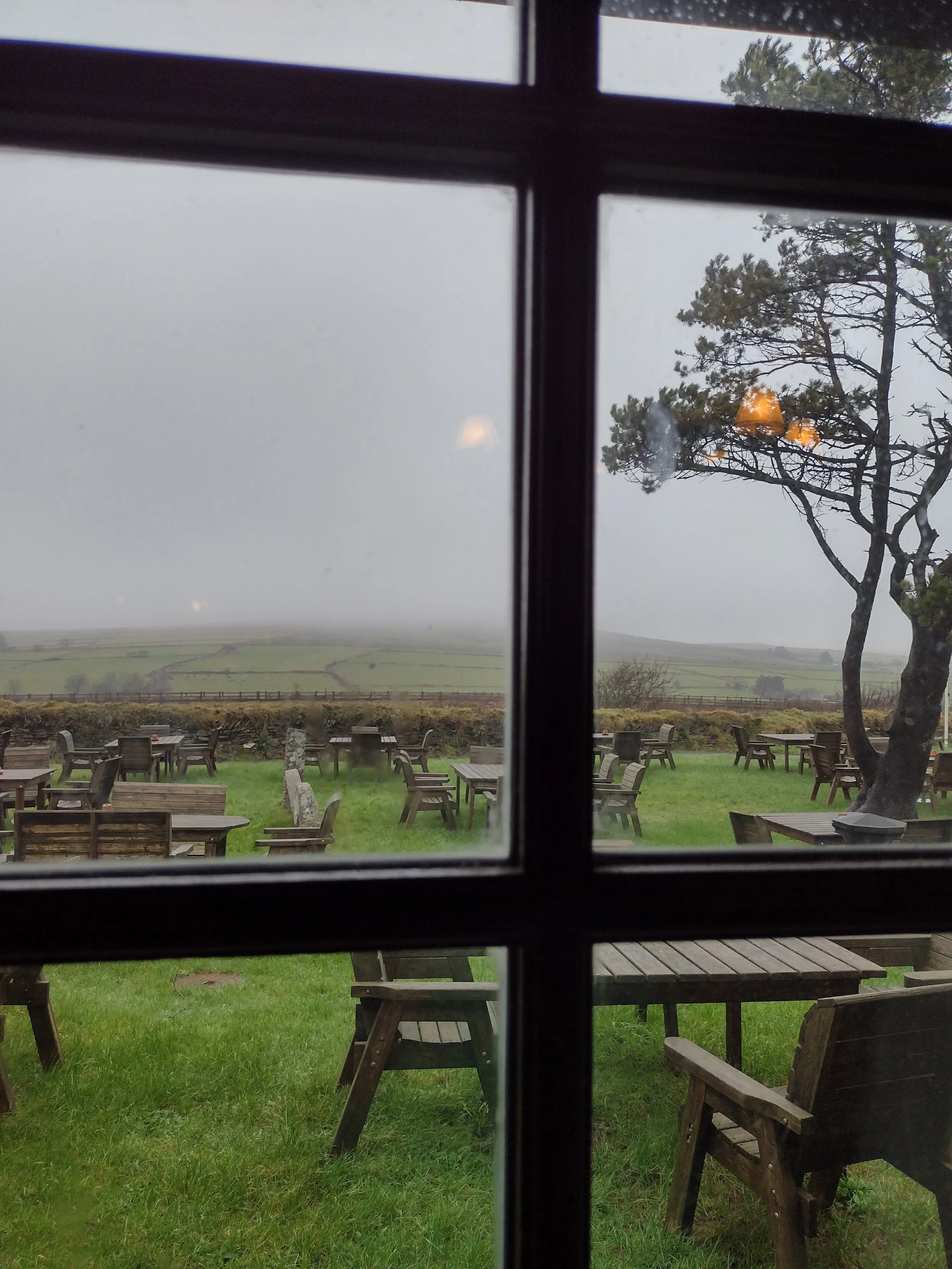
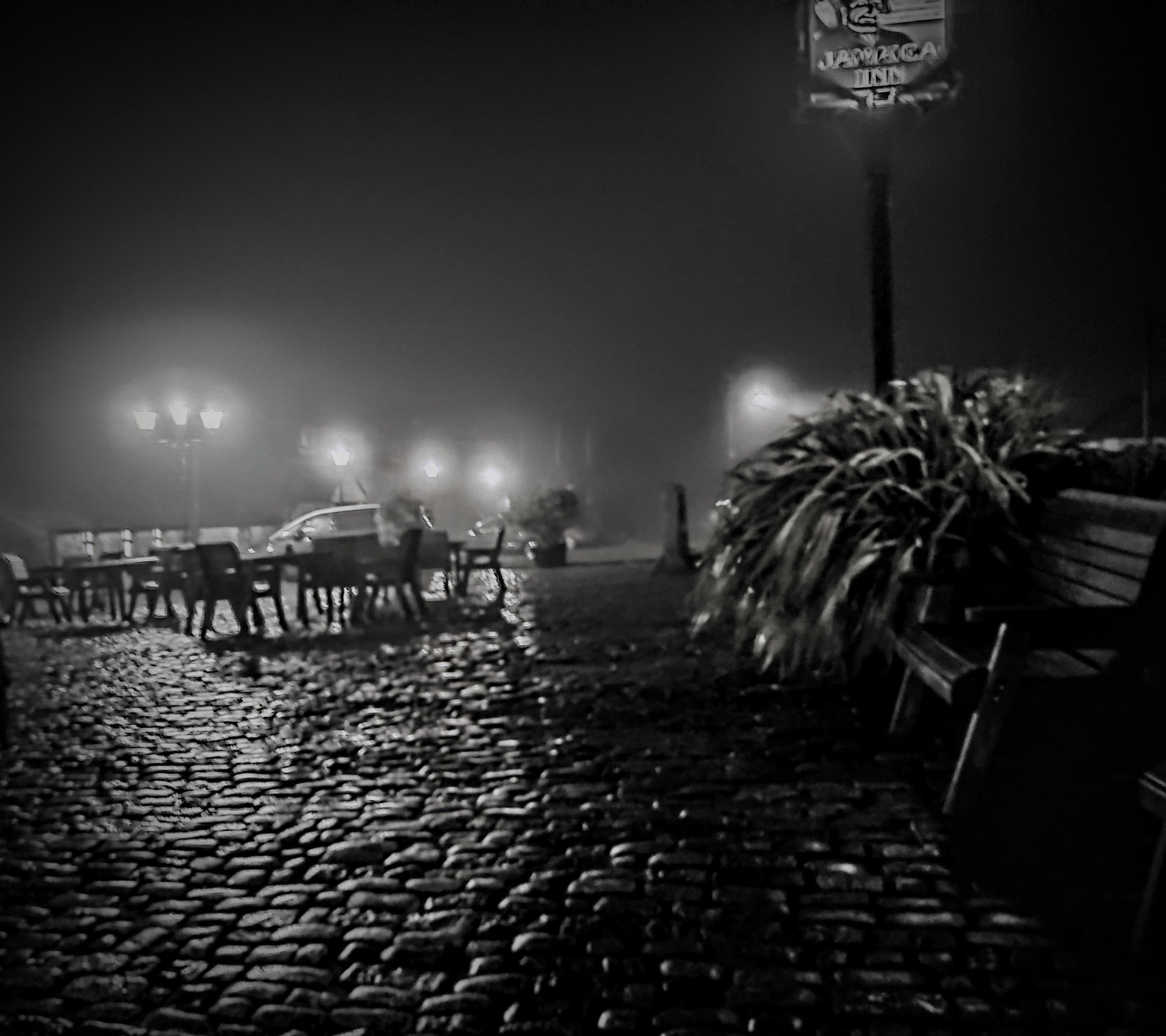
For my Birthday this year we booked a weekend at the amazing Jamaica Inn, a place that promises smugglers, ghosts and stories of the murky underworld and murders that lives and breathed in 17th C onwards Cornwall.


Being slap bang on Bodmin moor, you are very spoilt for the shear number of historical monuments there, literally you cannot throw a stone without hitting a stone circle or a hill fort. For instance behind the pub lies a lake with its very own Arthurian links and not more than 30 minutes away is the reputed ‘birth place’ of Arthur the mighty Tintagel.
Now Tintagel has taken full advantage of the less than provable links with the character and why you may ask, well its predominantly based upon the works of one Geoffrey of Monmouth and if you have read his great work the History of the Kings of Briton you will realise that it is at best described as pseudohistorical.
Full of dragons, giants, wizards, otherworldly beast and demons to name but a small few of what lies within, he also places Arthur at Tintagel, his Birth place and starts this all off with some very spurious links to a legendary leader of the Greek Troy who escaped here post trojan wars.
So lets take a look at the actual story, as written by Mr. Monmouth with an extract from that very story.

Tintagel the great striking and foreboding castle on the headland cut off from the land but only for a bridge, provided an almost impregnable fortress and according to Geoffrey and the legend, Arthur's father was Uther Pendragon, the king of all Britain. He goes to war against Gorlois, the Duke of Cornwall, to capture Gorlois' wife Igraine, with whom Uther has fallen in love. Gorlois defends himself against Uther's armies at his fort of Dimilioc, but he sends Igraine to stay safely within Tintagel Castle which is his most secure refuge, according to the legend and Historia Regum Britanniae. Uther besieges Dimilioc, telling his friend Ulfin how he loves Igraine, but Ulfin replies that it would be impossible to take Tintagel, for "it is right by the sea, and surrounded by the sea on all sides; and there is no other way into it, except that provided by a narrow rocky passage—and there, three armed warriors could forbid all entry, even if you took up your stand with the whole of Britain behind you." Geoffrey of Monmouth's story goes on to explain how the wizard Merlin is summoned and magically changes Uther's appearance to that of Gorlois to help get them into Tintagel Castle, while also changing his own and Ulfin's appearances to those of two of Gorlois' companions. Disguised thus, they are able to enter Tintagel where Uther goes to Igraine, and "in that night was the most famous of men, Arthur, conceived."[43]
As nice as the tale put forward by Monmouth is, there are a number of glaring mistakes, inaccuracies and laughable accounts that he had put forward, aside from the fact that ‘magic’ was not used, there was no castle and no knights in shinning armor.
So what is the truth!
The truth is well very murky, you see Arthur is such a complex mythology that it is hard to tease out what is truth and what is fiction, but lets try and have a look with more documentable and provable facts, the actual ‘castle’ you see today are the remains of a medieval structure built in 1230s by Richard 1st Earl of Cornwall and son to King John and Brother to King Henry, when he set about building the castle, no doubt he was inspired by the stories told at court and with the popularisation of Monmouth’s stories from 100 years earlier began to bring to life the legendary tale.


The castle itself served no defensive purpose at all being in such a place that served no strategic importance to the British empire, it does not sit on on any cross roads, protects no harbors or important inlets. Little is known about its function during this time other than being assumed it was a place of stature and known be a place to accept other Royalty and it is fair to say invite subjugated kings to see the English claims and links to the legendary Arthur and cement their right to rule over the kingdom.
What is interesting, if we take a massive step back to Monmouth’s reasons for writing such a work, you have to place yourself in his mind set and thinking, you see in 1135 when he starts to write about Arthur, the current King of England (Henry 1) had died and his Nephew Stephen of Blois became King, this was against an oath himself and other barons had sworn, he was unpopular and despite his good looks and prowess as a warrior he was thought of as lack luster and uninspiring and definitely receive much in the way of loyalty, at the same time the Welsh were rising again and starting to cause problems inspired by the story of the very Welsh legend of King Arthur and their claim to rule the kingdom, therefore making Arthur English would help to secure England’s claim to the throne.
We know that there has been evidence of human habitation from at least the 4th C with further evidence of Roman visitation but these are very small finds and cannot say for certain there was anything other than a passing occupation, there is virtually no evidence to suggest anything before the Romans and with many local hill forts in close proximity its unlikely it was used for anything strategic or for habitation.
Moving through and into the post Roman period, was left of the Roman world and the Brittonic peoples made this their home and no doubt would of felt safe here cut off from the main land, it became a thriving place with recent archeology work finding 5th C stone building complexes and possibly being one of several strong holds for the rulers of Cornwall, with its post Roman trade links to the Mediterranean it remained a rich and powerful place to live and rule over. This carried on well into the 7th C and it’s hard to imagine that stories or tales from this period of a rich and powerful ruler would not be used as part of the Arthurian legends.


In amongst all of this we know the Saxons began their colonization of the England around 410, with the West of England being under Britonic control and the western edge being under Saxon rule, (see map)

Its easy to see from the map that with only a small proportion of England being under Saxon control and this was very loose as each Saxon group also hated each other and there was no singular group. It could be surmised that Dumnonia was a strong hold out against the Saxon tide, that along with the Welsh, Northern and Scottish groups would perhaps pool armies and fight against the invasion giving rise to the myths of Arthur and in some cases Arthur is not a King but actually the right hand man of a lord or King who led armies to great victories.
Arthur which ever story you follow will of been a Britonic character, not a king but more likely a strong leader of men and second to the King of which ever land her hailed from.
Another issue with Monmouth’s story, their were no knights, the closest that existed were cavalry brought over as part of the Roman contingent who in some tales is suggested as being the inspiration for Arthur, these horse men were formidable even to the Romans and were well armored and to the British and even the Saxons such sights would of been shocking.
It’s unfortunate that as it’s name suggest the ‘Dark ages’ very little is actually written and what is has been told within the ark of Saxon poems and these themselves pose an issues as they were commissioned by which ever Saxon lord wanted a little fame and so stories were either altered or embossed to provide favoritism.
During the 14th C, the castle was a shadow of its former self, with a small staff and Chaplin employed to look after the once magnificent ruins but by the 1600s it was largely abandoned.
This remained so up until around the 19th C when Victorian England fascinated by the Romance and chivalric stories of Arthur and his knights, interestingly the post office actually gave Tintagel village its name, as Tintagel was the the name of the headland and not the main land, it was thought easier to name the village itself this way, in 1894 Rev Kinsman was honorary constable and built a court yard and a guide was employed and in the late 19th and early 20th C excavations began on naming certain areas such as King Arthurs footprint which legend says was used as Arthurs place to leap from one side the to the others and although it has been worked by human hands, possibly for some reason as far back as the dark ages it was romanticized by the English.
In the 1980s a fire raged on the headlands which helped to reveal much more of archelogy than first thought and in 1998 the Artognou stone spuriously described as Arthurs stone was uncovered. You may remember this from the news articles at the time which claimed it was linked to Arthur owing to the Latin name scribed into it, it was pushed by mainstream media at the time as evidential proof of Arthur, however when translated and examined it was believed to have been a practice stone for another purpose, broken in 2 and then used as part of a drainage system, even the name Artognou is suggested to be a very weak link to the actual name of Arthur and is translated as "Bear Knowing", from the Brittonic root *arto "bear" plus *gnāwo- "to know", and is cognate with the Old Breton name Arthnou and Welsh Arthneu.
This is only a very short insight into Arthurs, the story is so vast it stretches from Cornwall all the way into Scotland with stops in Cumbria and the Peak district, there a numerous other accounts, stories and tales written by multiple people which stan hundreds of years and I believe there will be no real one story of Arthur, my view is that Arthur was never a singular character, he was an amalgamation of stories and folk lore told by Britonic peoples, told through the many different periods of occupation of England and each telling was grown or expanded upon, Monmouth no doubt took Normal Chivalry and ideas of courtly and knightly behavior and imposed that upon his story to make is more of the time, make it more relatable for the Norman population to understand.
I’m hoping to create a road trip based around some the more notable legendary characters of the British isles and some that you may not know but are no less important.

The Birthday Boy 2.
Saturday the 3rd arrived and with it my 43rd birthday, for some reason had believed I was 44, I guess the passage of time had some what pickled ones brain.
I opened my cards and some presents, given to me by Mrs. Beard and my sister and we settled downstairs for our breakfast, the Inn during the day light presented as a mixture of different time periods, difficult to pinpoint with any accuracy which parts were original, the Inn was built in 1750 and due to becoming quite busy had an extension built in 1778 which included stables and a coach house.
There is some question as to its naming origins with some saying it is from the use of as a smuggling den to the naming in honor of a local family who had made extensive wealth from their time as governors in Jamaica .


It holds the dubious reputation of being a haven for smugglers which was rife throughout the many hidden coves of Cornwall. Tea and rum were heavily taxed during the 17th and 18thC and locals would banned together to lure ships into the rocky shoals in order to crash them and rob what expensive goods were aboard, owing to its position as the main turnpike between Launceston and Bodmin it was often reported being the stop off for the less than clean and holy.
We partook of a rather lovely if somewhat filling full English before we departed for the days adventures along with our companions. First driving the short distance to the famous Bodmin jail, it would seem the mist had not departed since its arrival yesterday and remained stuck to the mostly uninhabited places or sparsely populated hamlets of the winding and twisting roads and tracks. It was definitely an eye opener to imagine being an unfortunate prisoner sentenced to life or death in this most miserable of places, a rough and harsh carriage ride across open moor to arrive at somewhere that would not of looked out of place in any good gothic horror novel.
Ravens flew around the outside of the building providing an excellent story point to regale my companions with, the story of an unfortunate lady labeled as a witch but in truth nothing more than a healing lady known for mixing herbal remedies and providing cheaper cures to those in the area. She had befriended the local raven population and soon discovered how clever they were, being thankful that she had been feeding then and like their crow or magpie counterparts, they began taking shiny objects, silver, pocket watches and so forth from people, anger as they were and no doubt encourage by the local clergy she was found guilty of being a witch, brought to Bodmin the ravens joined her and spent their time harassing guards and other prisoners attempting to steal keys and silver wear for their master. She unfortunately passed whilst awaiting sentence and the ravens never left.
I do sometimes wonder why this kind of knowledge is retained in my brain as in ordinary day to day life serves little purpose.
We took part in a brief but excellent 4d experience in the bowls of the center, the wrecking of the ship is definitely one to experience, before being guided along and into a very small section of original cells where differing displays told the stories of life there, one we found hard to digest were the tales of children as young a 8 being interned with their parents for no other reason than they had been born to a convicted and a sentenced criminal. We all thought though it would of been nice to have seen more of the original jail but i guess most has been turned in rather expensive hotel accommodation.


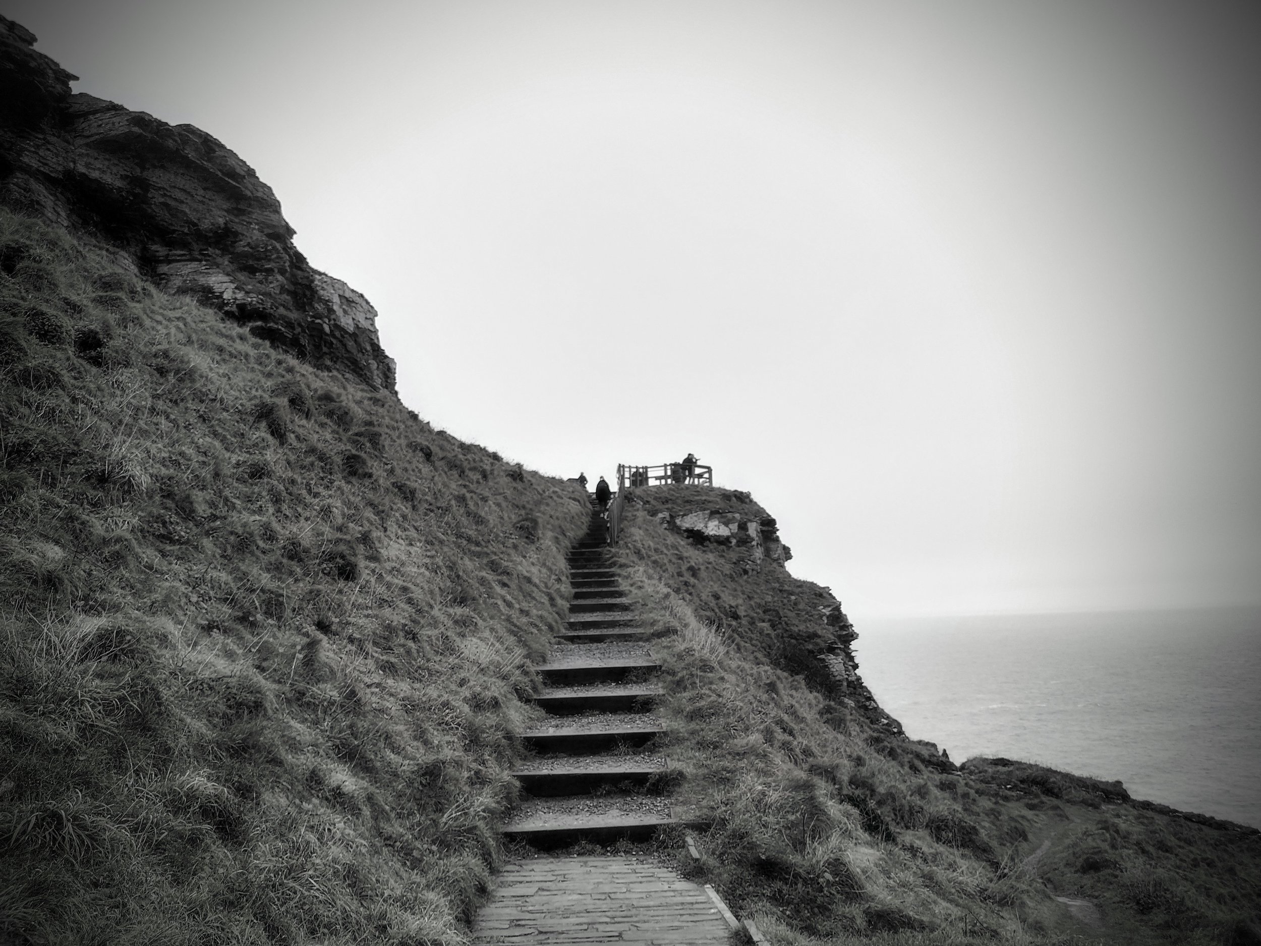
We departed and headed over to Tintagel once again, the roads winding and narrow speckled with the mist hanging like a wet woolen blanket over the landscape, still it was less spookier in the day time. We arrived and parked within easy walking of the castles start, as paying English Heritage members we were allowed in as part of our membership fee, this is probably one of the most middle age things we do, apart from myself running around at Christmas trying to locate all the Marks and Spencers biscuit tins.
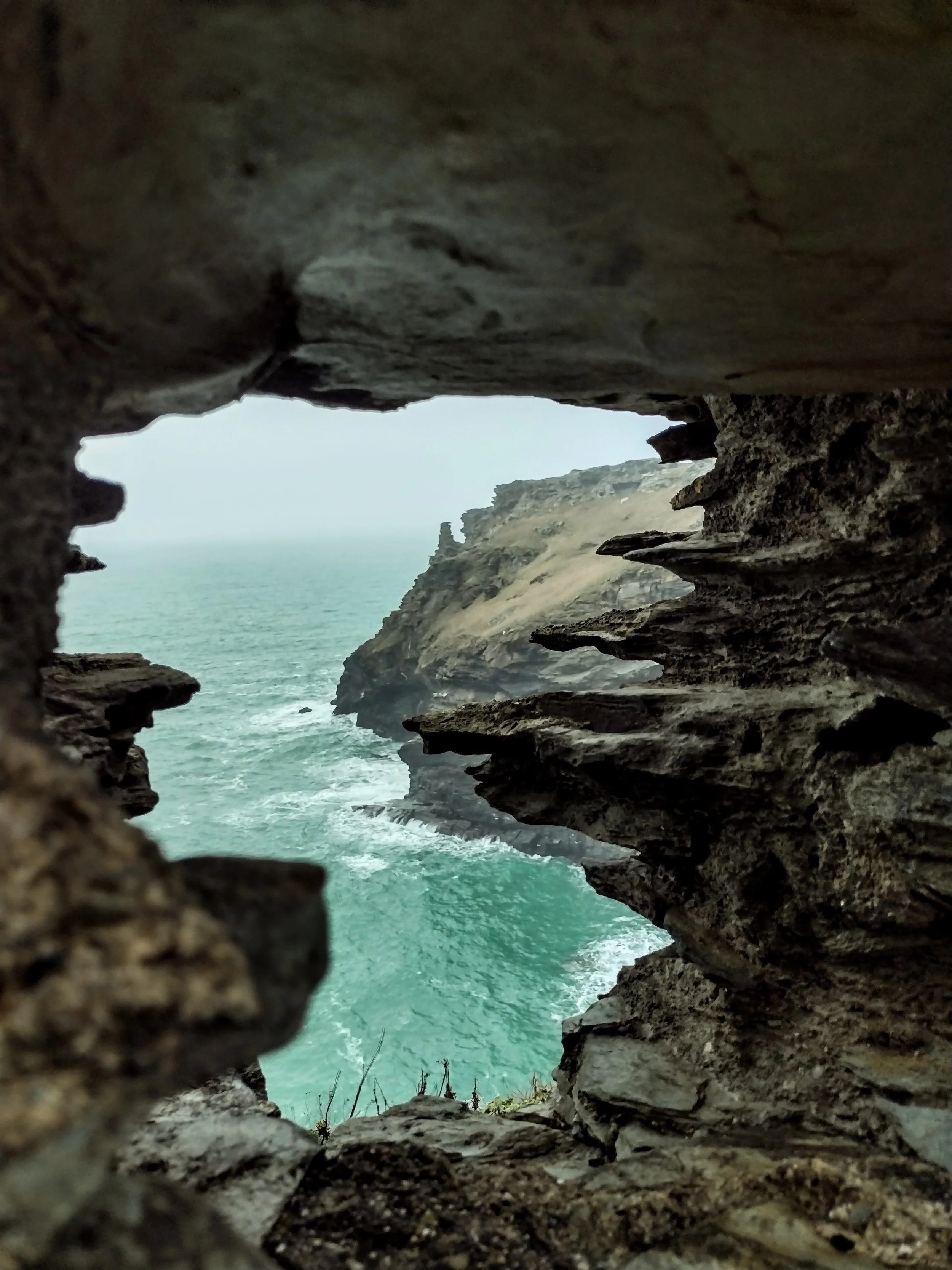
We made our way down through a simple but wide and well maintained footpath towards the base of the ruins, before slowly making a gradual climb up, taking in the many photo opportunities and majestic rock formations that bordered our way. Entering through a simple check point we were soon inside the start of the many and sprawling ruins, large walls having stood since the 12thC created secure and wind free court yards, offering both photo opportunities and a much needed break from the wind blowing in from the Westwardly squall of the Celtic sea.


around us also lay the ruin of the earliest inhabitants being 5th and 6th Century, don’t fret I have covered much of Tintagel’s history in another blog, the place buzzed with crowds from all corners of the globe today, families took the opportunity to capture those moments never to be revisited, pictures were taken at ever moment, cliff tops were explored with stunning views of the staggeringly beautiful coast line.
We wound our way along the path, one of our companions taking time out to capture selfies perched sitting on the cliff side much to his partners horror, she opted to walk away instead of bear witness to his untimely demise much to our amusement, but both she and Mrs. Beard took a brief interlude to grab one of their own.
Once at the top, we grabbed the obligatory picture with the most impressive King Arthur sculpture and then opted to take in the most bracing of winds and views, here I remarked that I could write a book based upon the best 50 places I have pooed in the UK, whilst our friend screamed in joy that she could fly like a bird as the wind blew heartily around her propping her up.
Myself and Mrs. Bearded opted to take the Landrover back up to the top as my feet were now starting to hurt, it instantly took me back to when I was a child and trundling around in the many skip like metal boxes we used to own, we had great fun though and as we rattled along the paths and every single inch of the vehicle made some form of dissatisfaction.


After a hearty Cornish pasty, we left for our 3rd and final destination of the day, Goliath falls. Passing familiar roads now clear for a change and into a realm that would not look out of place in tales of fairies and otherworldly magicians, moss and Deadman’s fingers covered every possible space here, tress usually dark greys and browns became almost illuminous green with streaks of grey/green blues hanging freely from exposed and tort branches, we would of loved to have stopped but the narrow road prevented any opportunist photos.
Pulling into the car park for Goliath Falls, a selection of small cabins took up one end, a cafe, moonshine distillery and a BBQ smoke house made a promise for the end of our walk. We set off swiftly, a short 20min round trip through ancient native woodlands, green moss covered every square inch reminding me of many a scene from Lord of the Rings trilogy.
Water soon sounded our destination was coming close, the roaring sounds louder as we edged closer and multiple waterfalls fells and gained speed through the little valley, we spent a short time here, by now unfortunately I was about done, my feet stung with the few miles they had covered today and so heading towards the Smoke house BBQ and after an amazing thick and creamy milkshake and some small bbq items for later, we headed back for a much needed nap until the evening meal.


There was little in the way of excitement that night, the energies of the day spent walking and exploring had taken their toll upon us and we opted for a quieter evening, meal completed, I was surprised with a happy birthday song and candles in my most delightful chocolate fondant.
A few drinks finished of a most delightful day before bed and the long drive home the following day.

Another year older.
Travelling back in time to celebrate moving forward
As humans we are ever surprised by the passing of time, always taken aback when a year comes and goes, its as if we are for ever stalked by the months fleeting by and then when New Years arrive we beckon in another world and the cycle starts again.
I for one have noticed the time going by, my diagnosis of cancer provided a reminder that life is finite, no one can live for ever and we must make the most of what is given.
This year 2024, I turn 43, another year older than my mother had always stated in angry tones that I would never make when younger, I have an odd relationship with my birthday these day, 4 years ago I turned 40 and I was unable to enjoy it due to illness, for ever suffering with headaches a few days post 40 and I was diagnosed with cancer.
This year is very different, I am now facing a fuller and longer life than I was 6 months ago, the cancer thanks to a new treatment has gradually been reduced to nothing.
This year is about me, about living and experiencing the world, feeling that I have been unable to so far. Gone were the usual discussion on where we would go, giving Mrs. Beard no option or say I took control and booked the famous Jamacia Inn, lonely sitting atop Bodmin moor once home to passing travelers, smuggles and general nefarious sorts.
We set forth from our home at around 9am, a quick stop along before leaving town to get the all to essential car snacks and we were heading out along the m5 towards our first stop off location. It never ceases to amaze me how people seem to loose all sense of reasoning whilst driving, their little chips which in ordinary life provide them with a list of commands and instructions to follow, but when driving it becomes faulty and people loose the ability to drive with any sense at all, I still laugh that the DVLA refused to give me my driving license stating ‘you no longer meet the safe driving criteria’.
Still we plod on, soon turning off the M5, following along the M40 and M42 respectively and then coming off onto the A429 and through idyllic Cotswold style villages resplendent with thatched roofs, these made for ideal for selling ‘England’ abroad to tourist, with the many wide open and flat fields it is not hard to see why when the Romans and later Saxons made much of this area their home.
We eventually pulled up the a large layby, large lorries and cars passed by at some speed which seemed at odds to the peace and tranquility of what lay beyond the hedge.
On our 3.5hr road trip we decided a brief stop over was needed and opted for the well known Rollright stones just outside of Long Compton, the stones today consist of around 70 odd stones, odd as the local legends tells that you can never quite count the same number twice and this certainly provided true and both myself and Mrs. Beard counted differing numbers.


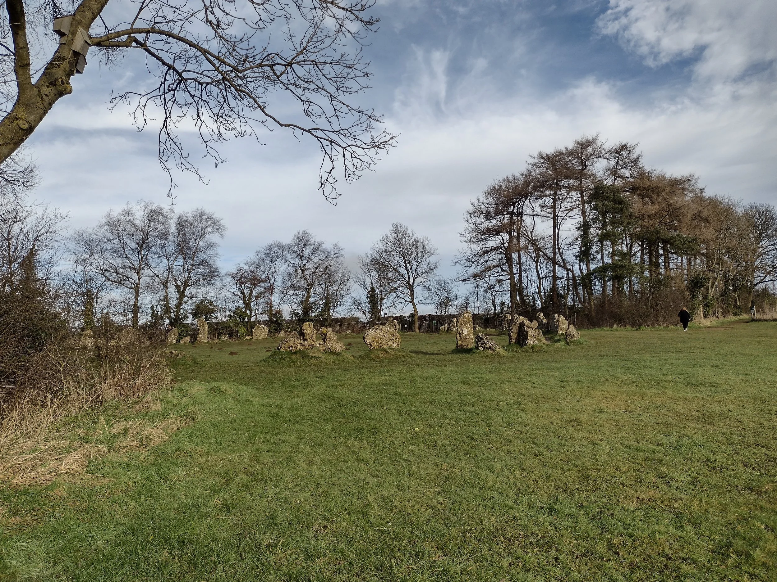


This little selection of ancient stones is around 2500 years old, as with all stones circles or monuments there is little known about why the were constructed, some ceremonial, some worship and some inline to celebrate the passing of the seasons, the stones are made of oolithic limestone which itself is a very unique geological stone, consisting of limestone weathered down and then re-constituted by the passage of time into almost concrete like stones. The weathering of rain, ice and frost creating worm eroded rustic rocks which only add to the already strange and mystic nature of the stones.
Originally some 105 stones were thought too stand at this spot, removed over time and usually around the birth of the puritan movement in where forces of the church concocted stories that these were the work of the devil and needed to removed and destroyed.
A short walk along a safe even path lays the whispering knights, once a place of burial for who ever was thought most important within the local area, now a wrought and twisted selection of rocks standing proud and behind a safe iron fence to try and protect their fragile structure, we wandered around, Mrs. Beard utilizing her dowsing rods in search of anything mystical. We retraced our steps, bracing the early morning breeze blowing in through the valley.
We waited at the busy roads at some times horrifying speeds and sensing a lull we quickly crossed and towards the King stone, this particular stone stands alone from the others, but holds a significant point none the less, excavations showed evidence that this area may have been important as a burial place, with other burial mounds, cairns and even early graves.
The Stones take their names from a legend about a king and his army who were marching over the Cotswolds when they met a witch who challenged the king saying, “Seven long strides shalt thou take and if Long Compton thou canst see, King of England thou shalt be”. On his seventh stride a mound rose up obscuring the view, and the witch turned them all to stone: the king became the King Stone; his army the King’s Men; and his knights the Whispering Knights (plotting treachery). The witch became an elder tree, supposedly still in the hedge: if it is cut the spell is broken the Stones will come back to life.

Once back inside the warm confines of the car, we set about stop number 2, much needed lunch and tea break and like most well respected middle class folk we enjoy a most excellent service station and non is more finer than Gloucester services. We arrived parked and made our way inside settling on a rather tasty Shawarma and salad, todays visit consisted of mainly people who looked as if they had been living presently in Ikea replete with all the necessities of the hipster lifestyle, still we enjoyed our drink and food before purchasing a drink and some brief snacks for the 3hrs that lay ahead.

A long boring and uninspiring motorway journey lay ahead of us, passing Bristol, the famous long suspension bridge over the channel before to long we were driving over the rugged and unforgiving beauty of the Bodmin moor, either side lay a dotting of farms and stark moors. The modern addition of the dual carriage way which carries one over the moors, seems in stark contracts to the thousands of years of human history and story telling which flanked its side, the weather presented as a heavy drizzle as we inched closer to the Jamaica Inn, sitting atop the old coaching road which served as the meeting points between important roads of the area, the weather only seemed to add to it mystery.
We waited a short time before our weekend companions arrived and settled on heading out to Tintagel to seek out the all important fish and chips by the sea, light began fading early as it does in winter time, the often one car wide lanes seemed to offer a more enclosed and sometimes spooky driving experience. We stopped in Tintagel and part took of our evening meal, before heading back to our accommodation the night had now drawn in and the mist had descended to no more than 10ft of visibility the same roads now reduced to a rather hair raising thrilling drive home.
Along the way we stopped at an old air field, once home to the RAF and built in 1942, it also quite interestingly held 3 formula one races in the 1950s, no however it became the setting for the start of a B flick horror movie, the darkness seemed smothering alongside the quite considerable mist. We got out of the car and I turned the lights off, the party of 4 became nothing but shadows which once separated became almost indiscernible to the darkness which now surrounded them, screams of delights and laughter filled the small space.
Once back at the Inn, we did the only thing which sensible and set about sampling the various Rums on offer of which there was some 20, bed time came and we bid good night to our friends hoping that the various spirits that inhabited the Inn.

Old Sarum
England is awash with tid bits of history, the signs of human habitation hidden under the very ground we wander across. Some places how ever leave their mark for all to see and usually these places are high.
Old Sarum was a place I had noted on another trip to see Stone Henge and Avebury a few years ago, but with time in short supply that day and the need to pre book saw this put to the side for another day. With a little road trip down south for another event, we opted to pop in for a stop on route.
With such a high vantage point it would be hard to miss the almost fairy tail crumbling ruins, deep ditches and banks of earth, in the earliest construction of the hill fort, it must of looked impressive as the hill is made up mainly of chalk, imagine a the white banks standing out against the green fields and forest, talk about status symbol.

Old Sarum has seen human habitation for some 5000 years, which is immense to think that at the earliest stages of man (prehistoric), this site was always deemed an important feature of the landscape. If you have ever been this way you will notice that it has its fair share of flatness and Old Sarum sticks out above the surrounding landscape.
Around 400bc, early Britons built the first of many fortification upon it, consisting of enormous ditches and banks that surrounds its roughly oval shape, being close to other notable hillforts and also two of the largest stones circles on the UK, Sarum was an important settlement, looking over and controlling an import intersection of trade routes.


Before the Romans entered the land, the fort was home to a group of celts who called the fort Caer Saflog or citadel of the service tree which grow locally and is thought to mean whitebeam.
With the arrival of the Romans, as with most hillforts Old Sarum was taken and became what is thought to be a Roman fort with a settlement outside the defended walls with many roads branching off to various important centers. This was common in the Roman period for the living and working areas to be on the outside of Roman forts, leaving the inside largely to the military, there is little known about this period of its life though. It is thought that the need for a hill fort reduced and the site was slowly disused by the military, during the end of the Roman and start of the Saxon period, it is known that a mint was built on the site with some evidence of a small Anglo-Saxon settlement also being found outside the ramparts. The Saxons in around AD55 threw out the Britons who had taken refuge in the fort after the Romans has left, this site became an important part of Saxon Wessex hence the mint.


With the arrival of the Normans shortly after their victory of 1066, the site became once more an important site of activity and power, the Normans quickly built a motte and bailey castle, the castle now sported two sets of defenses, the inner castle and the large outer ramparts and ditch, the large scale of the outer defense meant that it could house a large number of troop, the Normans keenly spotted that as with the Iron age period, Sarum sat and at a critical intersection of trade routes.
During this period, the inner section became home to a number of buildings, mainly built of timber, with the only stone sections being the outer keep/tower, a cathedral was also built at this time and its importance as a center of power was cemented, the Sheriffs of Wiltshire set up residence and the Cathedral became home to a body of clerks and scholars, the inclusion of a Scriptorium showed how important Old Sarum was to the Norman world.
For a short period, the site was left in charge of Bishop Roger, whilst king John I was away doing kingly type business abroad, after his death around 1139, Sarum became less popular as the New king King John II lavished money on his fancy new hunting lodge however by around the 1220s with the Royals failing to maintain its upkeep and the church and crown no longer getting on (think neighbor's from hell), the clergy moved into Salisbury and built and even grander Cathedral and city.
Habitation of the site hung on for a further few years, but by 1540 the castle and the dwellings outside the ramparts were no more, the castles mighty stone walls taken apart and used for other building projects.


Myth
It is said that Salisbury (new Sarum) was founded on the aim of an archer who stood atop Old Sarum and let an arrow fly. One theory as to how an arrow could of reached that far, is that the archer struck a deer which then ran off and died at the site of New Sarum.
Old Sarum and New Sarum has been identified and laying directly in line with the famous stone henge, leading to the theory that it sits atop a ley line.
The first cathedral had to be rebuilt after only a few weeks of being constructed, after having been struck by lightening.
Overall
The site is currently run by English Heritage, admission is £5.90 per adult and £3.50 per child, no toilets on site currently as these are being revamped.
there is a small shop that serves hot drinks from a machine, it is windy up there most of the time, but offers stunning views of the area, so take a blanket and wrap up warm on all but the suniest of days.

King Arthur Day 4
Another settled nights sleep, the weather helping to warm my aching bones through the night as rest allowed some reinvigoration of a tiering body.
I had slept well and the day already was warm, I was aware that my forearms were now burnt, the new tattoo I had completed back in the December the year before was reacting badly to the sun and seemed to burn even more so that anywhere else, I had stupidly forgotten my sunglasses as well which would of made a huge difference, I don’t think in all the times I had been out and about that I had experienced heat to this degree on consecutive days running,.
I carried out my usual routine, unpack the tent, drape tent over nearby hanging object, make food, pack bags, pack tent and off I go. This cycling lark was easy compared to running or walking, the tent could easily be stuffed on the open panier rack to dry in the breeze and sun thus saving time and not having to roll it up into a tiny item. You ever think that a tent is a bit like a block of butter, it never quite fits the packaging once opened.
Fueled with porridge and tea I set off around 7am today I was quite aware that my legs were stronger than I had thought, having covered some 100 odd miles already I knew todays journey would see me top 60 plus with 2 stops before finally arriving at home.
I pulled out of Cranberry Moss and headed for the roads and villages around the back of the main road, apart from the houses there was little else to say anyone lived here, not a car or a person was passed for some time and I often wonder if people in these little Hamlets live the lives of almost hermits and kept to themselves.
The lanes twisted with various wildlife and farm animals keeping me company in the void of human beings, it could almost be a pleasant view of a post human world, animals, nature and life itself just carries on being.


I began heading back towards Shrewsbury, being early afforded me again that luxury of time to meander and enjoy the journey plus the allure of breakfast was to strong a one to miss.
There was nothing exciting for the first part of journey this morning a gentle ride down into the small hamlet of Wilcott where a motte and bailey castle once stood looking over the Shropshire plains before arriving into Shrewsbury around 30 minutes later, I stopped at the first place I saw as open, the Loopy Shrew and a bacon sandwich, tea and the best hashbrowns ever, I sat in the sun and watched the day slowly roll into being, people busied themselves and hurried along.
Filled with breakfast fuel, I set off taking the streets out of Shrewsbury passing by the new, the old and Lords Hill tower, started in 1814 and commemorating General Hill who by all accounts was quit the soldier during the Napoleonic wars.
I was soon passing into the little village of Atcham and the rather grand bridge of Attingham Park before arriving at our first destination of Wroxceter.
I was to early for its opening and so I was forced to observe from the road way, still I was here last year and got to have a good look around and explore the vast and impressive remains of the once grand and important town.


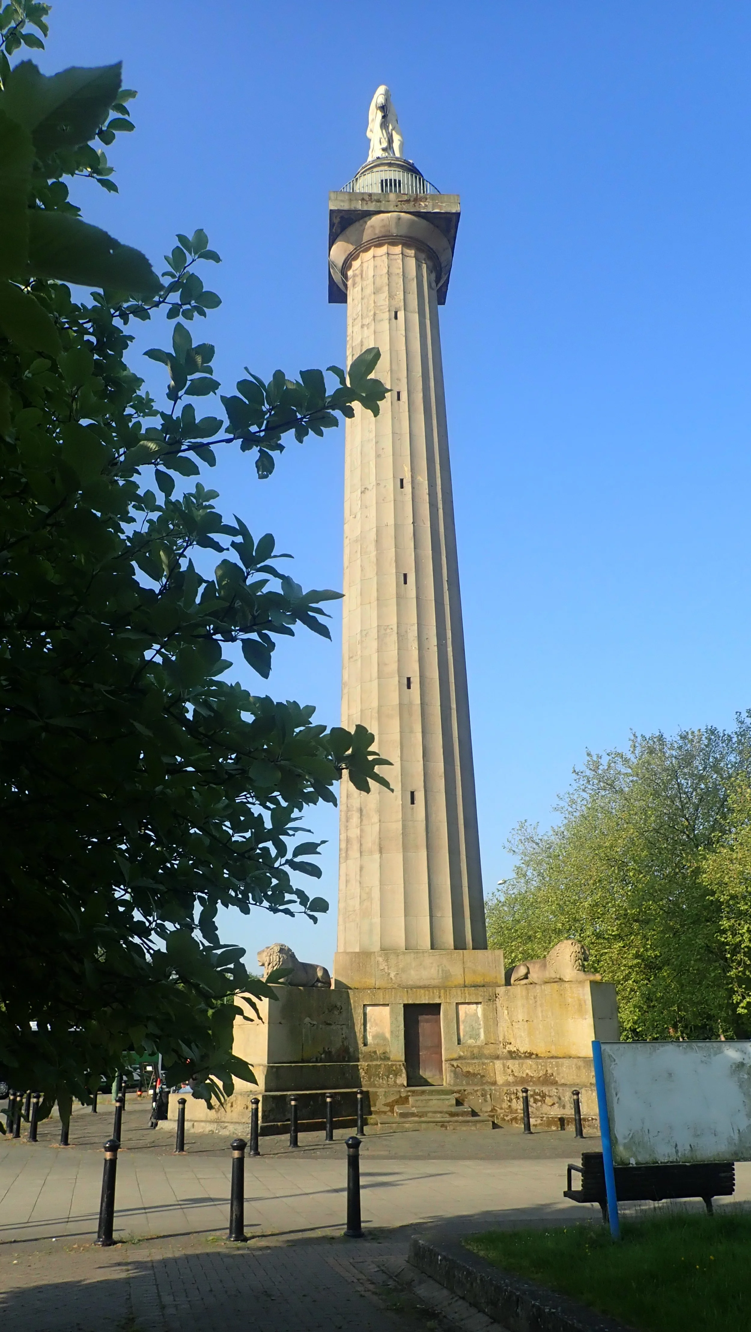


Every one likes to link Arthur to Camelot, the fabled city of righteousness and glory, home to the greatest king and his knights, but in truth the name Camelot was an invention by the French poet Chrétien de Troyes and was then copied and copied by subsequent telling’s, writing so far past the time of Arthur, the true name had been forgotten. Post Roman Britain was split into 6 kingdoms with Nennius, the 8th century monk claiming that Arthur was the leader of these alliances.
One of the oldest surviving reference to Arthur is the Song of Llywarch the Old in which the poet tells the tale of a descendant of Arthur having died in glorious battle and this relative ruled over the capital of Powys in the Dark ages, which was non other than the old Roman city of Viroconium and interestingly this city, now named Wroxceter remained walled and well fortified well into the century, with recent archeological digs noting major rebuilding work having taken place around AD500.
With stories placing Arthur has ruling the most important British city around AD500 and Viroconium being the most important British city, it fair to assume that this could indeed be Arthurs home city.


From here we potter along the quiet lanes and byways of the Shropshire countryside, I was passing the lower slopes of the Wrekin, a hill I had frequented quite a few times in the past, its looming shape commanding the landscape all around it, atop sits the formidable hill fort, despite its formidable size and defenses it was taken easily by the invading Romans and its inhabitants moved down in the lower valleys and Wroxceter.
I’m soon passing into the realms of the modern world again, Telfords built up areas seem to surround me as I meander through streets and industrial estate, I pass through villages and take time to grab a cold energy drink and an Ice cream, sitting under the fine and grand branches of an old sycamore tree in church yard.
I head around some industrial estate and noticed that I had at some time picked up a passenger, a rather lovely looking caterpillar we chatted fore a time it was more a one way conversation on my part and I dropped him off in a lovely Oak hedgerow before finding a very rare Bridleway behind a large industrial park, the welcome break from the traffic and noise straight into a very underuse piece of greenway.


Little towns came and went and all to soon I was coming to my final destination and the ending to an epic tale spanning centuries.
White Ladies Priory sits outside of Telford near to the famous Boscobel House, its generally accepted it was constructed or consecrated around the 12th Century although it exact dates cannot be confirmed and some believe it is much older and existed as a place of religion long before the Normans invaded.
At the fateful last battle of Arthur and subsequent his death, Guinevere left perhaps for safety perhaps knowing that the great kingdom had come to an end, made her way to White ladies Priory with fabled sword and took to life as a poor nun, hiding away from the world and everything she had once known. The priory today sits as nothing but a ruin, nestled in the middle of a quite and sedate woodland, it offers a place of reflection and contemplation, a time away from the bustling world, almost creating a bubble from the modern world.
My journey has taken me through thousands of years of rich British and Welsh history, from the oldest standing stones of ancient peoples to the more modern ruins of chapels and castles now just reminders of times past.


I’ve always loved the story of Arthur and with each myth told stems from a grain of truth, perhaps one day something tangible will be found to tell us here is Arthur, King of the Britons.

Arthur day 3
With day 3 came to awareness of the climb that I had before me today, the campsite was quiet with a slight mist covering the sleeping field, I packed away and made some much needed breakfast, sitting quietly in a chair by the shower block and watching the world slowly come to life, I had but one destination in mind today before camp and no real time frame set, I have to say I was thoroughly enjoying the cycling life, this was so much easier than running everywhere.


My original route planned for me to head across the Stapeley Hills and up into Shrewsbury, being further down I opted to take the roads that ran from the back of Runnis Meadow and heading up towards the bog, the roads here spoke of little use, moss and grass grew in the middle of the road, sheep fed with out care whilst birds of prey zoomed across the sky.
I followed the road around Radley Hill and was some climbing up towards The bog a once busy mining village and now only a few houses remain from the 200 that would of stood there, a visitors center is there but being early was closed so no early stop off for tea and cake.
I passed by Pennerley towards the the Stiperstone and onto Snailbeach where a large mine now awaits the intrepid explorer views greeted me from the gained elevation and I took a few moments here to appreciate the early morning view.
Eventually I headed down and into Pontesbury where a quick stop at the church for a snack, with ample time ahead of me, I followed a bridleway down and into Pontesford Hill, It was nice to have some off road riding for a short time, the steep rocky descent gave way to a muddy rutted tracked that threaded the bottom of Earls Hill fort, another great Iron age construction and finally appearing again onto the roads and onwards todays Montford Bridge and into Baschurch.


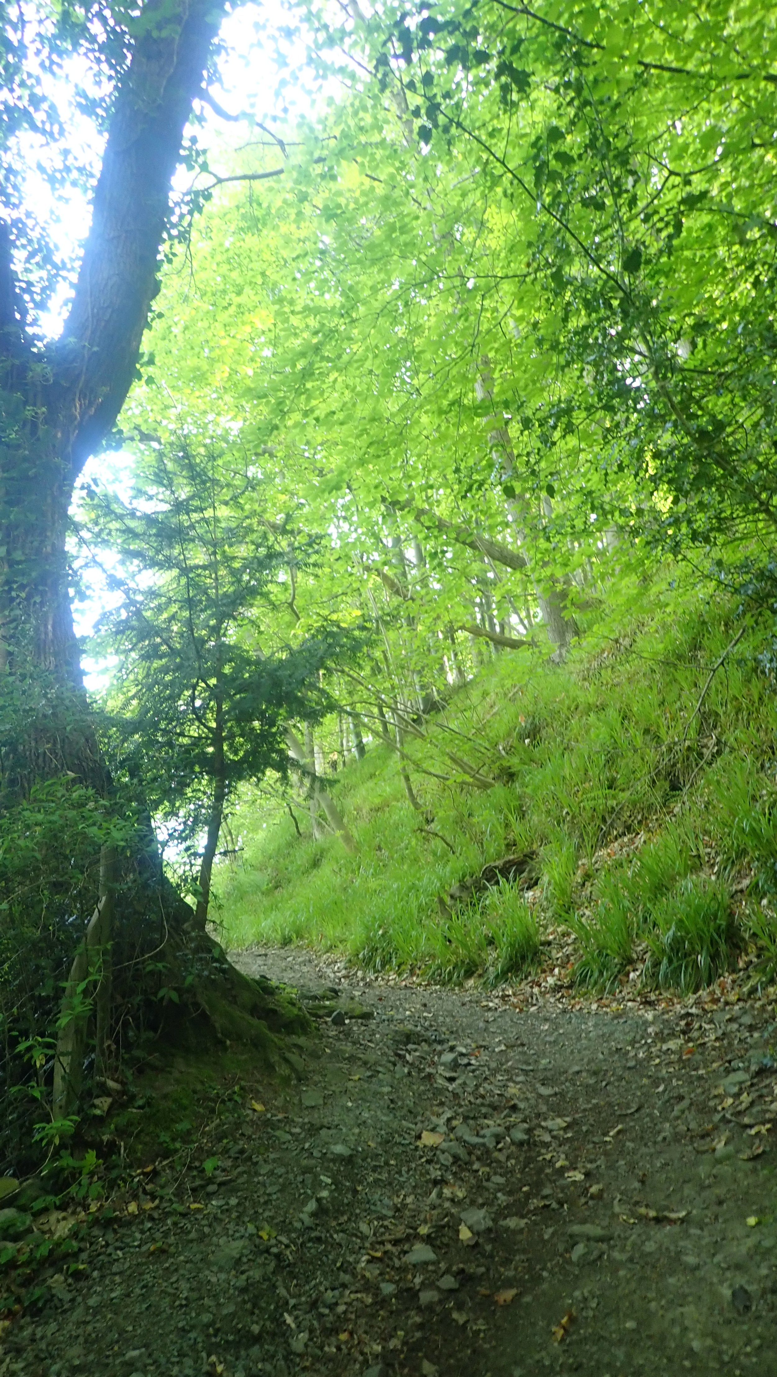
I took a rest here on a handy bench, here a chap out on his mobility scooter stopped to chat with me, people were much more willing to chat to me on the bike, if I had been running and camping I would of been avoided like the plague. He told me that he had early stages of dementia but still had enough about him to be independant, I let him chat away telling me about the many cars he had owned, my own current travel and then we were treated to a cracking view of the Bentley owners club outing, along with some rather amazing pre 1950s motors.
We said our good byes and I headed off to my destination for today, Berth hill sits just outside of Baschurch and you’d be forgiven for passing it by as nothing suggest it is there, I turned off the main road and onto a track that passed by a few houses, I knew there was no public access here and with some distance from the track there was no real easy way for me to wander across the field.
The Berth is quite a unique feature, Owain Ddantgwyn had been a king of Powys, and, astonishingly, the burial site of the kings of Powys was also revealed in the Song of Llywarch the Old, the work that relates how the Powys king Cynddylan had been a direct descendant of King Arthur. According to the author, Cynddylan was buried at a place called the “Churches of Bassa”, and that his predecessors, the former kings of Powys, were buried here too. As this included Owain Ddantgwyn, it would seem that the Churches of Bassa could well be the final resting place of King Arthur himself. The place today is called Baschurch and may well be to final resting place of the great King Arthur.
For it’s low lying position , the berth consist of 2 interconnected islands in what appears to be a lake with a causeway connecting them, in all of my travels and experiences of Iron age constructions I have yet to see anything that looks quite like this. There has been very little in the way of archeology here, not even any scans of the structures, it seems such a shame that something as simple as a scan could not be conducted by historic England, what could be an amazingly important sight has yet to give up its secrets.


I stopped at a lovely little farm shop outside of Baschurch and grabbed some much needed food, a rest inside away from the burning sun and I was again on my way, Brownhill, Ruyton XI towns, before popping past Nescliffe and onto my final camp of the evening Cranberry Moss.
Despite its close location to the main ring road, it was fairly quiet and I was able shower and reset, before eating a large amount of food including 2 rather delicious Cornish pasties and 2 more boiled eggs in my freeze dried food. This was living.
I settled into my early finish, it seemed slightly odd given my scurrying for a camp spot in days past, the scrambling through undergrowth and the ever present fear of being caught somewhere, now I relax in peace the sun warming my aching body. I did have to move a few time as the sun began to burn my exposed skin. With tent erected and airing my gear I made use of the shower block making a brew afterwards and listening to pod cast as I drifted in and out of sleep.
The site was deathly quiet come 10pm and despite the hum of the busy dual carriageway only a feet away I settled into a


Arthur day 2
I awoke on day 2, a restful night, well to a degree anyway I’m not one of these sleep right through kind of campers and will often wake in the early hours feeling fully rested and have to force myself back to sleep again.
What is strange is not having to wake at 5am and pack away in the cold damp morning and then set off running for 8hrs, now I can wake, take my time and actually eat breakfast.
I had set myself a goal of around 30-40 miles for each day, thinking I’m not as fit as I once was and new to cycling I had little idea of how I would get on. With the tent resting over the gate to dry the last of the morning dew and with breakfast and a hot drink inside me I planned my route for the day.
I passed by the little hamlets of Crewgreen and Wollaston before the inevitable push the bike up and onto Long Mountain, once up it became a very reasonable road which straddled the border of the Welsh and English border. Here your treated to a view which in the hot and sunny weather of today was nothing less than outstanding. Here I came across the odd bikers, some out for a morning ride, others enjoying their own bikepacking packing experience, albeit with a nice BnB slipped in for the added comfort.


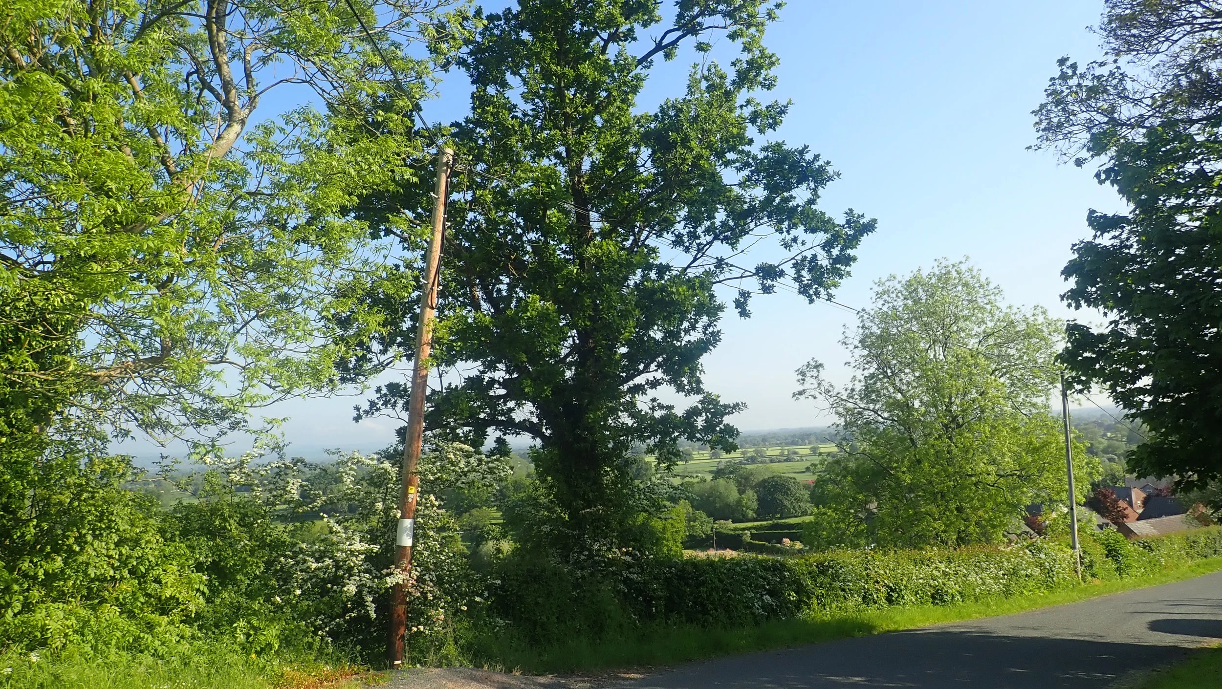


The road here becomes follows the line of an old Roman road which stretched from Wroxeter to Forden Gaer, with Offas Dyke and a Iron age hill fort thrown in this simple road offers allot. As I passed a woodland it was here that I realised what the infamous arrows represented, the hill was a tad on the steep side and as I cycled down I applied my breaks which then began to overheat with some smoke thrown in for good measure and then finally my breaks stopping altogether, a quick ditch in a hedge was called for.
Disaster averted and a rather embarrassing push my bike down a hill I was able to make good time along the A490 to our first stop of the day the River Camlad. Where a bridge now crosses the Camlad a ford would of originally sat here.
Today it is simply farm land with the river gently flowing between them, a campsite sits near to this bridge also but unfortunately does not take tents, seems to be a thing these day. But back in mist of time somewhere before 500 and the earliest mention being the Annales Cambriae from 537 mentions the strife of Camlann in which Arthur and Medraut fell, Medraut later became Mordred. What makes this hypothesis even more intriguing is that there are records of an actual battle having taken place on the moor above this place between 2 great armies. Either way many people pass over this very inconspicuous area without ever realising it importance to history.


I continue on, passing through Chirbury where I stop at the Church before heading into the local shop for a much needed pie and coke, I sat in the sun and watched people go to and through, before heading over the road and off to Mitchells fold. I cycled alongside a chap running his first ultra, what a day to pick a run certainly not one id of chosen.
Here we met one unbelievably steep hill that headed up to the farm of Lower Ridge, I took a much needed seat before carrying on pushing my bike onwards and upwards, I passed only one vehicle here a pick up truck which 10 minutes later returned my way, asked where I was headed and the farmer offered a much needed lift up and onto Mitchells fold. Once having reached the top I collected my bike and walked the short distance to my next stop for the day.
Mitchell’s fold is some 3000 years old, once comprising of 30 stones but now only 15 thanks in part to years of vandalism the most recent being in 2005 when a local farmer took down some stones and was later caught and prosecuted. Like all of the stone circles there is little to say what they were for other than theories and conjecture we can only imagine what would of taken place at their height of use.


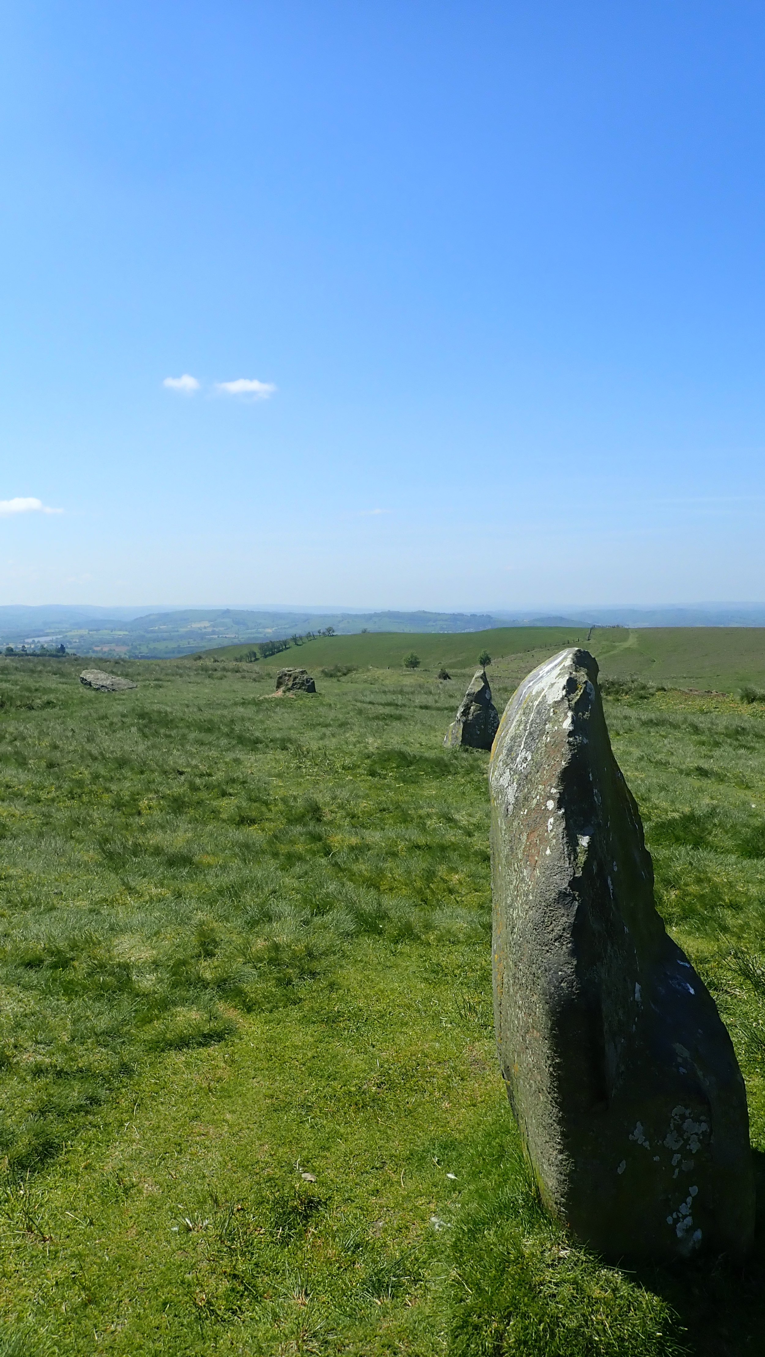


So why are we here today, well in the Arthurian legends, the great leader and king is said to have pulled a sword from a stone and then became King of all England. In all reality this is more likely down to one Geoffrey of Monmouth when he first put to paper the story of King Arthur turning him into a knight and king. You see the tale of the sword in the stone can actually be attributed to something tangible in history, when swords were first cast, a mold would be carefully produced from carving a large stone split into 2 halves and molten metal would then be poured into the hole and once cool a sword would be ‘pulled’ from the stone ready to be finished. With the many burial cairns, Tumli and forts that dot this area it is not surprising that Mitchell’s fold perhaps once held a sight of special importance to the area, it’s almost secluded spot within the many valleys of the Shropshire hills that Mitchell’s fold could of provided a place to anoint kings or choose leaders in some long forgotten ritual.
I sat, ate some snacks and soaked up the sun for a hour before heading off once again, I would of originally like to cycle across the Stapley Hills but there was little in the way of camping to be had, one thing I’ve come to realise from all my travels is that I really do not enjoy the whole looking for camp spots and hiding away. Now I prefer a camp site where I can relax in peace.
I headed down along the road towards Runnis Meadow, a large and spacious campsite bordered by a trickling river which im told is home to a family of otters. The owner is a great guy, even offering me a lift past the many and maddening hills that awaited me. I purchased some eggs from him, set up my temporary home and chilled out in the sun for what seemed like ages. There was no phone signal here and I was truly free from the confines of modern tech. Whilst my pod cast played I cooked my tea and added a few eggs for good measure I was now hungrier than I had every been and even with this in my belly I was still a little peckish. Night drew in eventually and I was able to get a good rest.


In search of King Arthur day 1.
There are times when as an avid explorer and all round adventure type person that you hit upon an idea that truly becomes a journey back in time.
My latest outing finds me adventuring across the Shropshire country side in search of non other than King Arthur himself, that mighty king of old racing around the land fighting great beast, rescuing fair maidens and generally being an all super great guy.
Well the truth is, (spoiler alert) he was never a knight and may have not even been a king, he was never any of those things. The stories we learned as kids and legends of old seem far from the truth that permeates the land.
So who was he, where did he come from and when?
One thing that I have come to learn from my general meanderings through the annuals of history is that these characters are rarely one person, they tend to be a conglomerate of different stories and people from different periods in history and with each new retelling the story teller has added a new detail to make the tale their own.
I had woke at 5am and set off for my 11mile cycle into Birmingham in order to catch my train, this being the first time I had travelled with my bike, the ticket having been bought some weeks earlier in order to book a space, at £9 and with no need to have booked a space (first come basis) it was already a barging.


It was strange waiting around this early in the morning, one that I had not done for some time, I sat around eating my breakfast bun and tea before boarding my one train straight to Chirk.
I had originally booked all the way to Wrexham with the idea of cycling the 15miles to Llangollen and the actual start of my adventure, but having looked at the route whilst on the train, Chirk to Llangollen was shorter, (famous last words)
I arrived at Chirk on time and having navigated myself from the train station, I set about checking out the route forward, taking in the many back roads and little bridleways that dotted this landscape aiming to cut my journey down to save on the old legs. My route took me out past Chirk Castle, skirting the mighty home and grounds and passing by parts of Offa’s Dyke, how ever after an hour and having pushed my bike uphill for the tenth time, I decided that heading to Llangollen was out of the question, I had pushed my bike for half a mile along what was supposed to be a bridleway, it had seen the passing of time and the underuse of people, with the way now overgrown with nettles and grass making the going quite interesting and strenuous.
I knew that once down towards Llangollen I would have to retrace my steps backs wards towards Oswestry and go over the same terrain I had struggled to navigate.
I stopped just outside of Pennant and instead began to head towards Oswestry Hill fort, I was new to cycling and was unaware of what the arrows represented on OS maps some pointing up and some down on the many roads ahead, I was soon to find that these demoted how big the gradient was but the steep descent down into Pontfadog was certainly a nice change to having to push my bike up the never ending steep hills.
I was soon climbing yet again out of Pontfadog, following The Maelor Way and eventually into Gobowen where I stopped for a Bacon Sarnie, the café was an interesting place one that seemed to attract the many and varied locals who offered stern and humorous warnings about heading through Oswestry, the lacalness ran strong here.


From Gobowen it was a short and pleasant ride along quiet roads and eventually hitting my fist point on Arthurs trail. Old Oswestry Hill fort is some 3000 years old, it sits as a mysterious and well preserved throw back to our ancestors and remained in use for around 1000 years.
The hill fort had seen 4 distinct phases of building with large and deep ditches and banks, the Welsh name for the hill fort, Caer Ogyrfan, means City of Gogyrfan. According to legend, Gogyrfan was father to Queen Guinevere and therefore father in law to King Arthur. It is said to have been the birthplace of Queen Ganhumara – Guinevere of Arthurian legend.
There was a great battle that took place here in 642 between 2 great kings of the time, Penda and Oswald. Penda of Mercia defeated Oswald of Northumberland and dismembered his body, placing body parts on stakes near to his death. The place became known as Oswaldstre, or Oswald’s Town, and subsequently Oswestry, another side note King Oswald was said to have been the last decedent of King Arthur.

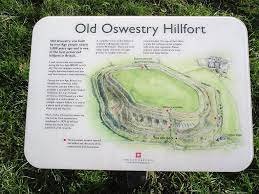

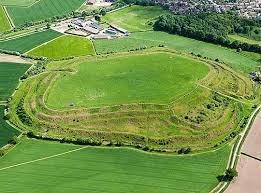


I’m soon on the move again, heading this time for Whittington Castle, I head out along the A495, threading my way along side the Saturday traffic, I peddle with ease along the road and I am soon coming upon my second Arthurian place, Whittington Castle.
I had been here a number of times before, to visit other notable myths of old, the castle cementing its place in not only the Arthurian legends but also that of Robin Hood.
Arriving I sample the delights they have to offer, it seems only fitting that I do this and admire my surroundings, the café’ sits with the grounds of what would of been a 13th C Norman castle, one of the many castles that made up the fortifications around the Welsh Marches.
Now the story goes that the ‘real grail’ was in fact something called the Marian Chalice, a cup used by Mary Magdalin and found in Christ Tomb after his execution by St Helen and then via many paths ended up at a destination we will later visit. The castle was built and lived in by the Percival family and the more notable Fitz Faulk Warren who are argued are the original grail protectors, the grail being hidden within the chapel here at Whittington. There is so much history here that it deserves a blog all on its own.


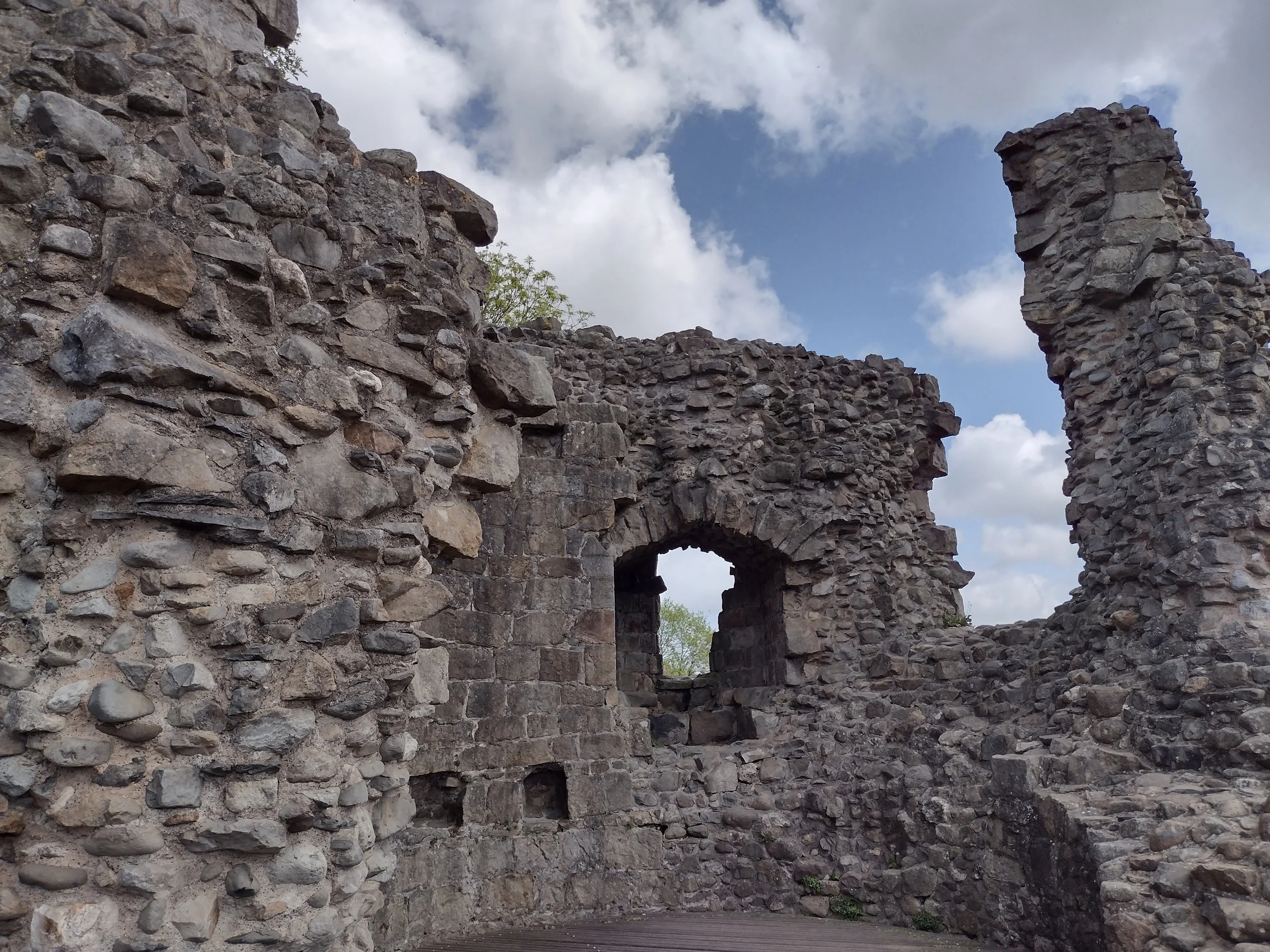

From here I set off towards my camp for the first night, one thing I have come to realise about bikepacking is the distance you can cover comfortably in a relatively short amount of time.
I threaded my way along quiet country lanes, gladly avoiding the many cars out on a Saturday drive, I was thankful for the warm weather, seemingly blessed by the travel gods, I was heading for my first camp, a little site at Crosslanes, I arrived well ahead of time and quickly finding the site, I settled into pitching my new tent, the site was quiet and spacious with only a toilet there, the whole field to myself.
The land was quiet even at mid afternoon, I snoozed on and off until it was time to eat, spending the hours reading and lazily absorbing the sun, this as a first introduction to bikepacking couldn't have been any better.


2024
Its funny how you are fully prepared for and aware at the same time of the year ending and another starting and yet seem to be fully unprepared for the actual reality of the new year.
Well here we are, survived another year in a world which seems intent on destroying itself and caring less and less about other that are affected, 2023 for was an odd year, I was once fit and stable with plans for the year and then from the blue cancer restruck and everything was upended.
I missed out on 2 fantastic weeks in Jamaica which we had booked to celebrate the previous 2 years of crap only to be scuppered by another load of rubbish.
Still, could be worse I guess, so were am I now, well I have stage 4 cancer, my future is uncertain in that there is little in the way of the cancer ever going away and so I am now planning for other things, I’m now officially now retired from being a nurse, I am no longer registered as a nurse and now have after 3 years have now taken back my driving licence back, with the freedom of now work, plenty of time on my hands and the added benefit of being able to access my pension early I am in a very fortunate position that most could only dream of.
I was talking with my wife around buckets list and where I want to go and the truth be told I am unsure, I don’t have a bucket list which may sound strange but I’ve never felt the need to have dream places to go that will ultimately never be a reality seems kinda pointless as my life has always been about obtaining what is reality and accessible.
This year for me is about connecting, connecting with friends and family, making memories with those that have stuck by me through everything and always had my back. I have the rough outline of plans for this year, places to go and things to see, wonders to touch and new experiences.
I feel lucky, lucky to be fully aware that my time is limited and that everyday is a gift to be cherished and made the most of, we all have ideas and place we want to go and things we want to do but in reality we stop ourselves with excuses that we can’t for some reason, but how long do we keep putting things off

Kingdoms lost
The man took his final sip of strong wine as he lay back upon the hay bale which had become his bed and resting place for so many years now, the night had been fully of revery, dancing and more than enough drinking.
He closed his eyes and fell into a deep and drunken sleep, but if the stories told are to be true he would never wake again, his body lost the cold dark sea.
Today Borth is a small seaside village on the West coast of Wales providing homes for both permanent residents and the many holiday makers who call Borth their home. It is situated not far from the bustling town of Aberystwyth and makes up the large Cardigan Bay stretching from Bardsey Island and Strumble head.


Beyound its quiet and quaint seaside persona lies a mystery which could stretch back as far as the last Ice age one passed down in the strong oral story telling tradition, a long held folk memory.
Cantre’r Gwaelod is a land lost to time, to foul deeds, carelessness or even an act of god.
There is no specific time frame for the tale to be placed in, but we do have a few characters to base the story upon.
Cantre’r Gwaelod was a mythical land said to have stretched between Ramsey Island and Bardsey Island and is now under the area known as Cardigan bay. its earliest mention is in the Black Book of Camarthen, written around the 1250 by a single scribe and written from tales within his life time and believed to be the earliest form written entirely in Welsh containing poems and tales including one of the mighty and ever so out of reach King Arthur.
There are many versions of this tale but all lead inevitably to the same place, Cantre’r Gwaelod was said to lie on the fertile flood plains in what is now Cardigan bay, its lands so valuable, that one hectare was equal to four for the rest of Wales. The land was ruled over by King Gwyddo and his palace close to what is now Aberystwyth.
The land owing to its low laying place required a complex system of weirs, gates and sea walls, King Gwyddno entrusted the protection of his land to his good friend, Prince Seithennyn and every night he would close the gates to protect the land from flooding.
Now depending on which story you read, it is some times a woman, sometimes a man, sometimes the woman was distracted by a love interest, tricked by another or either had been intoxicated, as in this tale, the kind held and great banquet and the keeper of the gates imbibed a tad to much, he passed out and the stormy sea coupled with the spring high tide flooded the 16 villages behind the walls.
What adds weight to this tale are the small points of evidence that seem to lend some credence to the tale, the Gough Map a mid 14th C map and thought to be the most accurate map of Britain before the 1600s was found, when researchers took a closer look they could see 2 distinct islands or land masses, one between Aberystwyth and Aberdovey and the other between there and Barmouth to the north.

Researchers believe these 2 land masses are perhaps left overs from the previous ice ages and slowly over time eroded by the sea and rivers, its date is still contested but some believe it to be an updated version of something much earlier but all agree that despite its mythological drawings that it is correct.
Along with the map, there are a number of causeways that project from different points along Cardigan bay with one being Sarn Badrig or St Patrick’s causeway and extends for about 20km from the shore and as it is easy to walk upon it more than lends its support for lost lands.
Just out from Borth and at low tide you can wander out and at first spot black blobs protruding from the sand, its not until you get closer that you can in fact see the remains of a forest, some 4,500 years old, submerged and hidden for most of the time, it was after a giant storm in 2014 uncovered the remains of a native forest that once flourished on the fertile plains, in the midst of time the Irish sea was quite shallow with only rivers flowing that could be crossed, but as ice melted and seas rose the rivers widened and became what is now the sea.

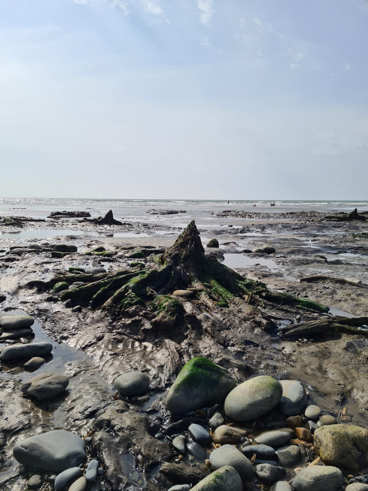
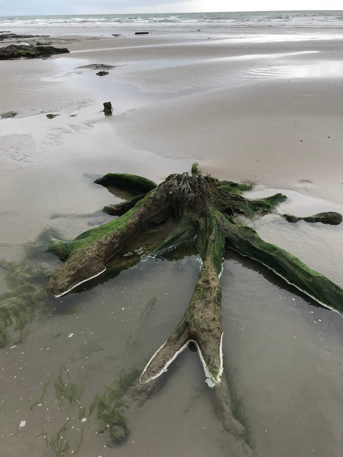
Unfortunately it being winter and in the midst of another storm we were not able to see anything on our trip so I’ve pinched a few images from the web.
Its fair to say that a land mass was once lived on, perhaps farmed and hunted on, people called it home and for a time perhaps flourished. If you familiar with the story of Dogger land then you will be very familiar with the land that once connected the UK to Europe and this land stretched for much of the East coast, that was until a catastrophic land slip originating in the far north of Europe triggered a monumental tsunami that flooded most of the UK and anything on the East coast was wiped from the map, there are also stories held with the oldest surviving stories of The Epic of Gilgamesh which predates the Christian great flood myth.
You may also be surprised to know that there are a further 3 tales of lands lost along the Welsh coast all recount a similar tale of the land suddenly being swallowed or taken by the sea with only a few if any survivors.
We may never know the full truth, but we do know that the sea was once lower than today, perhaps those early humans passed down the story of the great flood and over time it gathered new places and new characters.


Wild Eadric day 3
I slept with some comfort, my brain having forgotten that I had turned on the radiator to try and dry my socks from yesterday and the room became hot all night and by morning I was desperately needing a drink and cool morning air.
I began getting myself ready, a cup of tea followed by porridge in my new collapsible mug before dressing and packing my meager possessions for the final day and 20 miles to Ludlow.
I leave the room at 6.30am and head to the back of the pub and to rejoin the Shropshire way, my first few miles being a steady climb and up towards Bury ditches. The woodland is quiet at this time of the day and deer run about escaping my intrusion in their early morning feasting.
The air is settled around me around the sky’s are clear allowing me a view across towards Hopton Castle, the large banks of the fort begin to raise to to my left as the land drops down to my right.
Bury Ditches dates from around 5000 years ago when humans were in full swing of the farming lifestyle and used stones tools in their day to day life.


Bury Ditches is a spectacular example of a well defended enclosure and up until the 1970s very little was known about its existence until a large storm felled a large majority of trees on its top exposing some of the earth works and again in the 1980s further showing us what had lay hidden away.
2 large and deep ditches that would of been topped with formidable wooden fences with men stationed above and ready to throw down fire and death from above, what makes this an interesting place to others is the complex entrance ways where the walker is funneled through and around the defensive structures ensuring no easy access to the inner plateau.
A myth from old forms in my mind, a young boy makes a deal with a tricky fairy upon the hill, he wanting the pot of gold and unable to life it and carry it away ties a long and golden thread to it handle he walks back to the cottage he and his mother inhabit but on his way down he trips and the thread snaps. They search for many months but nothing is ever found again and the gold still sit hidden away on the hill somewhere.


down I trod and onto the car park for the hill, I had ended my last adventure here, the many cars that pulled up telling me that this was a ‘busy’ place for couples to meet on the evening and I took my leave quickly. Now how ever the car park was empty and bidding a farewell I wander the road for a little time before coming across a little cottage and farm, hidden away from the main roads of life, quietly watching time go by.
I was soon coming into the little village of Kempton, sleepy and empty it seemed to be hidden away in the world, with only one road into houses it was somewhere to remain hidden. Across the footpaths, tracks and hills I walk heading into Kempton, one thing is for sure this route certainly takes you through those small and forgotten villages and hamlets England does so well to give life to.


Farm land slowly begins to give way to the activities of humans as roads become more frequent and footpaths more common, from the greenery of the woodlands we are soon embraced with the glow and warmth of fields of Rapeseed, the yellow almost needing sunglasses to navigate, paths skirt Craven Arms, the call of tea and cake is strong here and I know there is a few cafe’s here, but I bolden my spirit and walk onward to Stokesay Castle where I am able to take a rest within the café here, what makes this even more sweet a deal, 20% off all food.
As I sit and eat, I’m mindful that the closure I get to areas of population people are less inclined to speak to strangers, those of us that tread the boundaries of society become ones to avoid or pay little attention too and in some instances make purposeful moves to avoid.
Stokesay Castle is currently run by English Heritage, Laurence of Ludlow was one of the richest men in the country at the time having made his fortune through wool and although built as it was, Laurence wanted to demonstrate his wealth and power. Despite its strong walls and defence’’ it was none the less built to reassure the Welsh lord who were more than keen to borrow from Laurence.


I bid my farewell to this rather distinguished home and headed out once more into the miles of farmlands, passing 2 rather eager train enthusiast and their equipment which seemed to cost more than my entire camping gear and off through more woodlands before coming down into Onibury and take a moment to sit in the delightful church yard.
Having struggled through countless pieces of farm land where crops were long and signs were few, I could no long bear the thought of trying to walk across even more freshly ploughed fields and instead pootle along the country lane towards Ludlow before coming out and on the gold course come racecourse.
I’ve never been a fan of golf course, they seem to take up large areas of land and only provide enjoyment to a few who are able to pay for the privilege, as I walk the busy B4365 I note that this area seems to be rich in burial mounds with 3 in very short distance of each other. One lie to the side of the main road here, resplendent with a giant and majestic tree growing from its Centre. This area once home to an very important ancient cemetery, one of the 20 odd barrows were excavated in the 1800s and the remains of a small boy were found along with some grave goods.


I head into Ludlow itself, my end in sight people mill around and non seem to keen to speak with myself as I wander the street heading for the front of the mighty castle and just as soon as it started my walk has now ended, I take a seat on a bench and spend a moment in contemplation before heading off towards the train station and home.


Clun - Bury Ditches - Hopesay - Stokesay Castle - stanton Lacey - Ludlow Castle.
20 miles walked
weather remained dry for the most part,
signs became less frequent through farmers fields who seemed very keen to take less effort to direct the walker.
I cream tea and coke consumed.

Wild Eaadric, Day 2
Day 2. Wild Eadric’s Way
I wake at 5am, the world outside still and with life just starting to rouse itself from slumber, the ground shod in a frosty damp that covers everything it touches.
I make my way to the bathroom, my feet bare now cold and wet inside the already cold and wet trainers, I climb back into the warmth of my bed, but not before having been doused with the condensation that now covers the inside of my tent.
7am arrives and I begin to start packing away my gear and carefully separate the now wet outer from the dryer interior, at this point think wet bin bag that sticks to everything that it touches. I carefully lay out the contents on a little patch of gravel where the sun has begun to shed its light upon the ground, I make use of the warm wet room, its radiator providing me with some much needed warmth and a handy dryer for my once wet socks.


Breakfast is a simple affair of tea and porridge mixed with hot chocolate powder inside the dry cabin of the site and set off into Bishops Castle, the sleepy Saturday morning streets slowly coming to life, I head down towards St John the Baptists Church and turn left on to Kerry Lane which is part of the 15 mile ancient track way, used for centuries by cattle drovers to take cattle from Wales to England.
After climbing for what seemed like an eternity I turn left and onto Moat Lane, now officially in Wales it would seem, I pass small hamlets of buildings and long forgotten Motte and Bailey Castles set above the fantastic countryside. The welcome warmth of the day making a much needed change from the weather I had suffered yesterday.
I never used to be a fan of road walking back in the day, but find them easy to amble along these day and tend to pass some of the quieter places and villages. I pass the ruins of Caer Din, hidden inside a field with no public access. A late prehistoric enclosed settlement, not likely a fort as such but more a defended place to live. I find it odd that on all my travels very few of these places have every really been explored in the archeological sense which seems a shame considering the amount of history waiting to be found there.
I opt to keep walking down the road and at the Dog and Duck cottage I turn left and head down the little quiet track towards Lower Edenhope, I head through a gate, the sheep now waiting for me and even allow me to pet them, a short climb and onto a track through an un-named woods where I take a break and soak up the sun for a short time, I relaise as I set off that I had somehow missed the footpath, thanks in full to who ever decided to clear fell the woodland here, leaving no trace of the footpath.
Still I wander fourth and through more woodland with a quick hop of a fence I am reconnected with Offa’s dyke, built by the King of Mercia in the 750s to keep Mercia and the kingdom of Powys separate, now a 170 mile walking route, I’m glad I joined here and didn’t have to walk straight up the incline behind me.


I am grateful that such places exist for people like myself to wander along these days, the link between the modern and old world is at this moment one, you can imagine the many men working hard to build the ditch and at one point I imagined that I heard the talking of men and clattering of metal as they worked.
I met another walker on this section, a chap wandering the Offa’s Dyke trail, we exchanged our pleasant if short greetings before taking our separate paths. A steep walk down the Dyke and then into Church Town, less of a town and more a church and 2 houses, before again walking up and out of this little tiny valley on what seemed to be an enormously steep section forcing me to take regular and much needed breaks, A mixture of pasture and high land forms the next few miles, pleasantries are exchanged with people as we pass and makes the day of sun all that better.
I come down towards Clun, the castle looming in the far off distance and taking an ever more romantic feature to head towards, the walk down in to Clun threaded through little tracks which resemble nothing more than muddy rivers until we hit the River Clun and keep it to our left as we walk along scenic footpaths across fields before coming upon the might castle.
Clun Castle started its life as a simple motte and bailey, that simple wooden keep surrounded by a ditch and wooden palisade around 1150 and within 20 years it had been converted to stone, Clun never grew into anything more than a simple village, but the now rugged ruins remains as a testament to the Normans hold over their new land.


I head into the shop and purchase lunch for tomorrow, a steak pie and pork pie followed by heading into the White Horse pub for a well earned Ploughman’s lunch and a pint of beer, I’m shown to my room afterwards where I hang out as much of my wet gear as I can before settling in for the night.
Bishops castle - Bishops Moat - Lower Edenhope - Church Town - Cefn - Clun.
14 miles in all.
Weather bright and Sunny, took plenty of time to sit, relax and soak up the rays.
Got lost x1.

Wild Eadric’s Way
Walking in the footsteps of the Anglo-Saxons
I woke at that ungodly hour in between the unnatural time to be awake and the time when one should wake.
The world outside was still, shod in its blanket of darkness and dimly lit only by the glowing amber of the street lights. I stirred from my bed and began my once familiar routine of moving around the house as if I was a trained ninja silently dressing and collecting my items of adventure before moving out and into the darkness of the streets.
It seemed strange, this was once the normal routine during park run, getting ready and making the hour journey into Birmingham to board the train and off to a new destination.


I walked to the tram stop, bracing myself against the cool morning air before boarding the early morning transport and watched as the rain began to flow down the windows, a foretelling of what was to come for my day ahead. I noted that nothing had changed from the last time I had taken this journey, people went about their day heading to work, most sat silent engaged in their phones and seemingly blind to the outside world.
The train arrives into New Street and I thread my way through the crowd of early morning commuters, heading through the barriers and onto the concourse before purchasing a hot cup of tea and a much needed breakfast roll.
I sat waiting for my train on the platform and watched others come and go before boarding my own train and settling into the journey for an hour to Shrewsbury where I stepped onto another train for a short 30 minute ride and into Church Stretton.
Having seen the rain streak across the windows on my journey there, I had donned my waterproof clothing already and realised that I had unintentionally packed the lighter rain shell, to late to do anything about it now I mumbled to myself. I walked through the sleepy little town before stopping for some cash, a seemingly more rare commodity in todays world and made my way towards the enclosed valley of Cardingmill, an 18th C mill once stood in the Valley and the area was renowned for its wool making, Carding coming from one of the 3 processes involved in wool making.
It never ceases to amaze me when wandering along the road here, the hills large and looming on either side creating a otherworldly feel, no wonder that during the Victorian period it was named ‘little Switzerland’ owning to the way in which the house hugged the hillsides. One wanders along the modern road way, a curt contrast between the 900,00 millon’s of creation and modern mans attempts to subjugate it.


I walk alongside the fast and flowing river, its burbling sound keeping me company as my lungs begin to burn and gasp for air, I take regular and small breaks as I slowly ascend the hillside and into the thickening mist, my view now obscured to all but 20ft. I recall a story from the recesses of my mind, a black dog of demons haunts this hill preying on the weary hiker. Its jet black fur punctuated only by the red glow of its eyes and the terrifying growl that freezes humans in their tracks and on a day such as this it isn’t hard to imagine a beast stalking me from beyond my sight.
My mind plays out the previous routes that I took 5 years ago and I glide across the terrain with barely a glance at my route planning, a left turn here, a wander along the road, past a small pool of water and up and over another section of moor. As I began to descend the grassy hill, cows resting at the bottom began to call out in anticipation of my arrival which seemed to spark the interest of the adjoining field of young male calves who begin to run down the hill, in their eyes as a welcoming party of snorting and dribbling bodies, to me a stampeding mess of danger. I now run at pace heading for the closest gate and manage to hop the metal gate before realizing the cows were in fact kept behind another fence and posed no real danger to me.
They gather at the fence adjacent to the road and I bid them good day as I wander by enjoying the scenery and to a degree the weather which changed with the regularity of our current government between light showers and the that ever more wetter rain drops.


I run through my stories of Wild Eadric for the camera, recalling the tales of a man once respected and feared, now a shadow of his former Saxon stature, living under the rule of a crueler invading King, his lords content with attacking Eadric at every turn until he finally reaches his limit of patience and he sets out to attack the very people who killed his beloved King.
Its a tale not really known outside of the Shropshire and Welsh border region, a hero of old and now cemented in folklore for a future generation to tell as their own from a time where little is understood and ancient gods still ruled their lives.
I pass through the little hamlets of Rattlinghope and Bridges before taking the long slow hill walk up to the Stipertones, a brooding and foreboding collection of ancient and weathered rock stands atop its ridge beckoning the brave to come explore.
A tale from old tells of how Eadric having sworn loyalty to the Norman lord, enraged his people and they employed the services of a travelling wizard who cast a curse upon Eadric and his soldiers, forever interning their soles in the rocks, only to be released on the world at England’s greatest need, some say they have seen Eadric and his ‘wild hunt’ ride across the sky on the outbreak of the Crimean war, WW1 and WW2.
I forgo my walk up to the rocks today, the weather begins to close in and take a more darker and moody light, the skies now increasing their wet onslaught upon the few brave soles that skirt the ridge today. I cross the road and onto farm land heading into a woodland and the hope of a small semblances of respite from the continuing rain, I find a small space under low hanging branches before taking off again towards Nipstone rocks, I pass what appears to be the remnants of an old quarry, boulders dispersed loosely across the ground and small sections of dry stone walls attribute to mans follies.
The paths winds and threads its way through a mixture of gorse and heather moorland, punctuated by growths of conifer plantations, the route hitting the bottom of a field, now only what can be described as a bath made up of mud and water from the local stream, I carefully pick my way across the obstacle and up onto another road, the rain having taken its toll for the last few hours, sees me taking a well earned break inside a farmers shed, fresh dry hay making a most welcome pit stop, if only for a short time.


I move on, and off into the rain and avoid taking the higher route up Linley Hill and instead follow the quiet road and into Heys wood, ancient and noble beech trees line my way, old growths of Oak and Holly stand guard to my left, the trees standing immobile in a world that seems to ever need to change, I always wonder what trees have seen, the people that have passed and the moments in history kept within its old and scarred bark, one such piece of graffiti notes a 1945 date and I’m left wondering if a passing soldier on training wanted to leave his mark before embarking on another journey.
We wander now along the road, quiet and empty for the time of day and passed a rather grand house, Linley Hall built by the Moore family around the 1720’s, it stands as a reminder to the grander times, when the super rich explored the world and created these lavish homes, now I believe a private residence.
I skirt the little village of More and the remains of a motte and bailey castle, the once strong hold of the manor of More in the 11th C, now nothing more than a few raised areas of fields. I wander on towards the village of Lydham the field in front a reminder that farmers can be funny old folk when it comes to land, here the signs seems to disappear and little points the way, in the distance I spy the next sign post which does little to direct you, a guess here and there and I am now walking along a busy road and off towards more famers fields.
Walking, forever walking towards Upper Heblands, I hit B4385 and opt to walk its simple path towards my final destination of Bishops castle, the road is bus with cars flying past and doing very little to slow as they see me walking the verge, I am soon wandering up the driveway to FoxHoles castle camping, a wonderful little campsite situated just 10 minutes outside of Bishops Castle and commanding excellent views of the surrounding country side, local rumor tells that Haile Selassie visited here during his exile after defeat at the hands of the fascist Mussolini.


I pay my £10 fee and head towards the tent field, the rain beats down and I quickly throw together my MSR tent, the inside has become slightly damp and everything I own is now wet, I sit immobile inside the warmth of my clean dry clothes and sleeping gear, for 2 hours the rain beats down and Spotify keeps me company as I nap and by 7pm the world is now still, a warmth emanates from the evening sun and I can now readjust the tent fabric, take my wet items to the dry room and make my evening meal.
I sit, satisfied and warm.
15 miles walked.
Church streeton, Ratlinghope, Bridges, Stiperstones, Nipstone Rocks, Linley, More, Lydham and Bishops Castle.
Wet underfoot, rained for 7hrs. not to cold. Everything covered in mud.
For today you follow the Shropshire Way, easy signage.
0 other walkers met
Lots of Cows and Sheep.

A few days back in time.
It is that time of year again when my annual birthday comes around, tinged with that forever memory of first being diagnosed with cancer and at the same time a moment of happiness as we became man and wife, with Mrs Beards Birthday as well a few weeks later, I decided that we deserved something a little more special and booked a national trust cottage at the fantastic site of Avebury.
We headed off with adventure pup for what would be 3 days of history and relaxation in a place we both felt was extraordinarily special, on our way we popped into Marlborough for some supplies and a quick look.
Now Marlborough is an interesting place and seems to exude money from its very core, people wandered around looking as if they have just stepped off a family estate worth more than a small village and wearing clothing costing more than my cars are worth, but still they were very pleasant and with adventure pup behaving she seemed to draw the pets and admirations today.
In the grounds of the college just at the periphery of the town and unbeknown to me at the time sits a large 62 foot prehistoric burial mound with legend and folklore telling us that this is where the bones of merlin now lie and is a similar age to nearby Silbury hill bearing an uncanny resemblance to its taller sibling.
We found little there other than a few interesting shops and loaded with some snacks we headed for Fishlock cottage in Avebury circle itself, an 18th Century 1 bedroom cottage nestled within 5000 years of human history.
Once unpacked we settled in quickly and with no phone signal or wifi it was a welcome break from the hustle of daily life and jobs and one we both needed. We made use of the local Red Lion reputed to be one of the most haunted pubs in the UK for its ample ale supply and of course Wifi, well we aren't savages are well.
Day 2
I woke early and set off on a run with adventure dog, the grounds cloaked in a magical and mysterious mist, adding a feel to this ancient center of worship that perhaps our ancestors would of felt some 4000 years ago, we ran its bank and followed a little road out of town for a short distance before heading back and through the church yard where the mist clung to everything around it.


We opt for a delightful bacon sarnie courtesy of the local shop before heading out for a 3mile wander taking in Silbury Hill, West Kennet Long Barrow and then back along the West Kennet Avenue. The map was supplied by the national trust and used a print out of OS mapping which was ideal, a short walk and we were at our start of the National Trust car park before crossing the extremely busy A4361 and along the path to Waden hill, a likely through back the Anglo-Saxons and slight change to the name of Wodin Hill.
The path down reminded me of the Southdown’s, hard and compact in the baking sun, but slippery and sticky like clay in the wet of winter, each foot step making one move slightly to the side as you went, Silbury Hill was soon upon us and stood proud by the A4 itself a Roman Road. It is a protected monument these days with nu public access onto it, this is important to remember that being made of chalk is prone to damage and wear very easily.


Silbury Hill is an artificial chalk mound built during the Neolithic period and measures 129ft high making it the largest manmade hill in Europe and has a similar volume to the Egyptian Pyramids. Some estimates put the length of construction to some 500 men working for 15 years straight, the outer ditch is thought to have been made in order to construct the mound itself and completed over quite a few years, its use is still unknown with many saying a ceremonial or spiritual purpose.
We move on and cross the busier A4 making quick the gap in traffic as large lorries whizzed by at great speed, we headed up a slight incline and onto the even more amazing West Kennet Long Barrow, constructed some 5600 years ago it is perhaps one of the best examples of such a site in the UK and was used over a period of 1000 years.
It sits at 328ft long and 10ft high, there are 5 chambers inside and extends for 42ft, as you can see from the photo the stones is quite polished in places which is a result of the stones having been in a fast flowing river at some time in its life, with one stone appearing to have an ear lobe carved into it.


With 42 skeletons having been found inside with some complete and some not, it was thought that at times, bones were removed from the site and used in ceremonies and ancestor worship, the large stone on the outside of the barrow were there as a warning to others to its importance and around 2000bc the site was filled in with rubble and not disturbed until the 19th C.
We spent a little time here, I stood inside in the quite and felt immediately settled there, the chambers here are said to resonate at different hertz giving off both feelings of calm and trepidation, us humans cannot heard these frequencies but they have been found to have an effect of the psychology of the mind.
We left West Kennet and headed back along the path towards the A4 again crossing it quickly and up and over Waden hill before heading up along the West Kennet avenue of stones, Sarsens flanked us either side and we felt a sense of importance and connected with ancient times as we walked its central path back towards Avebury.
Originally 100 stones would of made up a wide avenue or procession way which would of connected the sites of Avebury and the Sanctuary 1.5 miles away. During excavations 4 bodies were discovered there along with scatterings of bones along its way, suggesting an important ceremonial route in its day. Interestingly the procession way seems to have had little use suggesting it was used only on special occasions, chalk being easily worn away.


It wasn’t long before we were crossing back over the busy road and once again stepping into the mass of stones at Avebury, perhaps echoing some long forgotten ritual entrance as our ancestors would of done, with appetites worked up we took a stroll over to the national trust site and partook of some chili and tea before spending the remainder of our time ambling around the Keiller museum which holds a number of important finds from the tireless work he carried out, before heading into Avebury manor which was home to Keiller and his life’s work.
We wandered around the many grand room, once restored by BBC ones a house in time, each room now a testament to the lives of its previous residents, although some are not the biggest fan of the work carried out by the TV show with one room being a little off from what would of actually have been there.
Day 3
We have a leisurely morning, breakfast of bacon and kindly supplied tea gift from the national trust, before making our way off again and in the town of Devizes, an 11th Century market town built around the castle, which today is a private residence. The town was bustling with people going about their daily lives and we opted for a cuppa and a cake during our little meander, the town boasts some 500 listed buildings, we got the feeling the town would be better suited to the seaside, having that nautical feels with its old buildings and many small passageways.
We left feeling refreshed and headed back towards Avebury again, where we spent the rest of they day chilling in the cottage and reading the many books on offer. That evening as night time feel, we heading off into the circle itself for some night trail photography, with limited light sources it was the perfect place to mess, we stood behind the cottage and noted how the stones seemed to absorbed the sound whilst stood in front created an echo that stretched off in the outer edge of the bank.


It was definitely an eye opener to have that briefest of glimpses into the past, the bank in its hey day would of been some 50ft higher, the many stones absorbing and echoing back the sounds of drums and people as fires created shadows that would of made the whole place seem like it was dancing.
We spent a good few hours wandering and taking different shots around the circle before gathering in the pub again for a well earned pint.
Unfortunately our time was at an end and by 10am the next day we were packed up and heading off again, not before a stop at the most English village I think I have ever been to, Bourton-on-the Water, one I have told people if I had to sell England as a place to other countries, then this would be the place.
Built in that typical Cotswold honey colored stone and nicknamed the Venice of the Cotswold’s and with some 4000 years of human existence in the area, it is certainly a place to visit in your life time.

Avebury, a place in time.
We stopped at Avebury stone henge recently but I wanted to give it its own feature, given that there is around 5000 years or more of history in one place it would be a shame to resign it to a small mention of the main blog.
Avebury is around 5000 years old, built during the late Neolithic period when people in the UK were just starting to live together and farm the land, prior to this we were still hunters and gatherers, during this period people from Europe crossed the sea armed with new methods for growing food and crop seeds and so the era of the hunter gatherer started to come to an end, the loss of one way of life and the creation of another.
Avebury wasn’t built all in one go, more that it was continually changed and shaped over several hundred years consisting of firstly an outer bank, ditch, inner stone circle which in its self surrounds a further 2 stone circles.

Stones were likely taken from the actual site or from the nearby Fyfield Down, where Sarsen stones still exist today and the site is the best evidence of Sarsen left in the UK, Sarsen interestingly is a result of what was sand deposited by seas or rivers, over time it slowly absorbed dissolved silica and eventually became stone which was very hard wearing almost like granite. It would also be an fair assumption that one stone existed here before the ring was even conceived, a large towering lump of sarsen where hunters would of gathered beneath for reference in the land, if this was the case the sigh of such a large piece of stone would of awed early man, perhaps even thinking it was left by their creators.

How it may have been constructed
It was largely abandoned by the Iron age and then by the middle ages Avebury was being dismantled and destroyed. Its position in the landscape is itself important, laying in chalk land in the upper Kennet valley that is a catchment for the River Kennet and a contains a large number of seasonal springs, around 4500 BC it appears that the environment itself changed from predominantly woodland to farm land as there is little pollen found in chalk soils from this period.
Archeology from the neolithic time was limited to a large collection of flint working not far away and a dig found post holes which some have suggested was a larger building, but with no dating evidence or even further digs it would be impossible to put a date on this, if true it would put its age near to the start of Stone Henge.

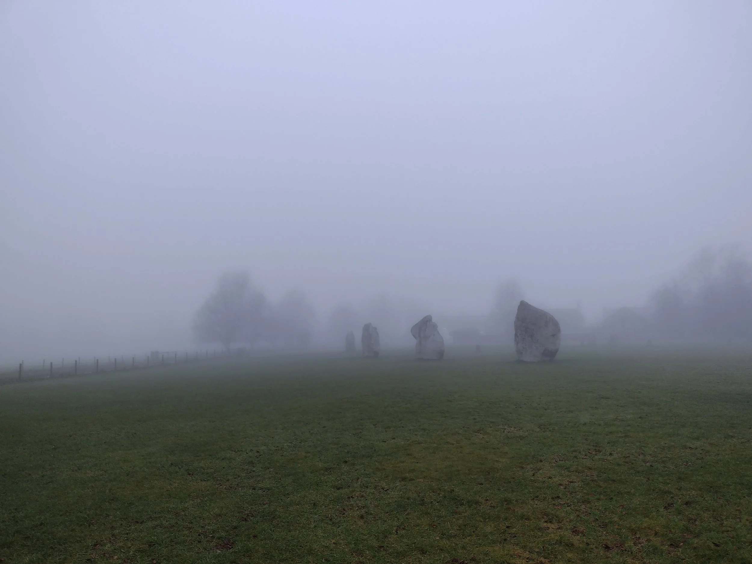


The construction of Avebury at this point in history helps to show that people were secure enough to be able to devote significant time to its construction, indicating they had a secure food source, water and safety.
The entire site sits across some 28 acres in all, with the outer circumference measuring over 1000ft, a bank that reached 55 feet high and the ditch plunging to nearly 30ft, with chalk being the rubble dug from the ditch its gleaming white banks would of looked immensely impressive at the time.
The site would of been made up of between 98-105 stones forming the outer circle are irregular in size and shape, the inner circles came together around what would of been the larges stone, the Obelisk would of reached a whopping 21ft high and 8 feet in diameter with very early descriptions making it phallic in appearance and giving rise to some suggestion that this particular area was for fertility.


The whole site would of been created by hand, with many hundreds of people digging with antler and jaw bone through the relatively soft chalk and pilling it up, this in its self is some undertaking, let along the combined human resources needed to complete such a project.
During the Roman period in Britain there is little evidence to suggest they paid much attention to it, with only a few coins having been found, however during the Anglo-Saxon reign there is good evidence to suggest they had a close link or settlements in the area from the common names given such as Wodin’s barrow or Wondin’s hill. Avebury’s earliest mention comes from this very period, around 939 and notes the boundaries of the village, nearby Silbury hill was fortified at this time as the Vikings rampaged across the land.
We can shudder today at our forebearers behavior, but during the medieval period the stones were buried in the ground or destroyed, this was in response to much of England becoming Christian and the churches almost demonic need to destroy or link with the devil in order to retain their hold on the land. During the 1930s excavations a stone was lifted and the body of a male was discovered underneath, it was said this was the result of the stones being toppled and one falling and crushing the man to death, its a nice little tale but it is more likely that as the church and Abbey were at constant loggerheads that this person belonged to neither and buried under the stone for ease. It was at the time of his death that locals stopped pulling the stones down, maybe in fear of more revenge.
It wasn’t until the Victorian era that Avebury was finally protected from further destruction by the purchase of the village and land surrounding the area, Sir John Lubbock encourage people to build outside of the henge rather than within it. With the 1920s an heir to the marmalade fortune Alexander Keiler purchased the village and much of the land around it, as homes became vacant he pulled them down as did the National trust until 1979 where the remainder of the homes were allowed to stand.
Not far away you have a procession of stones that head straight to the Sanctuary another henge constructed of mainly wood and stone and coupled with the nearby West Kennet long barrow and Silbury hill, the area certainly held a significant site of importance for thousands of years.


We had visited Avebury before a number of years ago and were taken with it then, the large stones some weighing 40 tons are a sight to be seen and offer the traveler a perspective of what it must have been like to enter this place of worship and significance.
One evening we were taking pictures at the site when I noticed that my voice created an echo that my wife could not hear very well, when we switched places the same thing happened, the stone we stood at acted as a barrier absorbing any incoming sounds, but stood no more than 6 feet way a loud and audible echo was heard which seemed to emanate from the darkness, on another occasion we were walking down from the cottage towards the outer circle and sacred tree when he church began to ring its bells, the sound appeared to be in front of us and then behind until it grew louder the further away we were.
I know there has been previous studies on sound resonance in the circle with it showing that sound from outside the henge would of been difficult to hear, lending it even more mystery and air and other experiments creating echo’s from the few stones left, but these are best achieved in the absence of visitors and cars.


During its heigh of power and importance and complete with its 160 odd stones, the acoustics must of been exceptional with music, chanting and ceremonies creating a spectacular atmosphere, having been and spent some time there, I was able to get better impression of the site and its landscape, the low mist that hung over the henge and other local sites gives you a sense of what our ancestors would of seen or experienced.
If indeed it was a sight of fertility significance then would it be fair to suggest that Stone henge celebrated death, the 2 sites being used at Spring for rebirth and Stone henge for death or end of seasons. Another thing that struck me recently was the close resemblance to the enigmatic cup and ring markings found throughout the UK and most heavily on Ilkley moor, the use of the circle seems to have been of a significance for the time.
What ever its original purpose, there is no denying that Avebury is a special place, a place that needs to be protected and understood, maybe we will never fully understand its significance but to each that visit it means something individual.


